(Click on photographs to see a larger version. Note: Some file sizes are quite large; not recommended for people using a dial-up connection. Photo album is here.)
Monday 8 August 2005 – to Sydney
We flew to Sydney and stayed at a motel not far from Bankstown airport, where the tour departs from on Tuesday. For dinner we indulged in a pizza from the place next door to the motel, washed down with a very nice bottle of Clancy’s red wine.
Tuesday 9 August 2005 – Sydney to Birdsville
Locations: Bankstown (S33 55.46 E150 59.30) -> Dubbo, NSW (S32 13.0 E148 34.5) -> Bourke, NSW (S30 02.3 E145 57.1) -> Thargomindah, Qld (S27 59.2 E143 48.7) -> Birdsville, Qld (S25 53.8 E 139 20.9)
We needed to be at Bankstown airport, ready to leave on the tour at 6:15 a.m. The taxi arrived a little early, but the driver failed to listen to me or look at the map the tour director had provided, so we went to the wrong area of the airport. Jean is not polite with idiots at that hour of the morning, but eventually the driver agreed he had it wrong and drove us to the correct place.
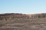
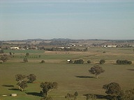 We flew northwest in a twin-engine 10-seater Piper Chieftain plane, arriving at Dubbo (NSW) around 8 a.m. We saw galahs and a couple of foxes on the airport grounds as we were landing. (Photo left: Countryside near Dubbo.)
We had a 20 knot headwind most of the way, and were behind schedule by Bourke if not before. At each stop the airport facilities got smaller, and fewer, and more isolated.
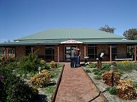 The terminal at Bourke was named after pioneering aviatrix Nancy Bird in 1995. She took flying lessons from Charles Kingsford Smith (the terminal at Sydney is named after him) at the age of seventeen. Smith was always short of cash, so he didn’t turn down a paying customer, although he did not approve of women flying. She gained commercial licence No 494 at when she was nineteen, becoming the first woman commercial pilotin Australia, and the youngest in the world at the time. She flew for the Far West Children’s Health Scheme, based in Bourke, and later did similar work from Cunnamulla in Western Queensland. She was Commandant of the Women’s Air Training Corp during WWII. Nancy Bird was awarded an OBE (1966) and an AO (1990) for her contributions to aviation. (Photo right: Airport at Bourke.)
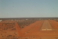 At Thargominda, the area was deserted except for the fuel attendant. We got away a little before 1 p.m. Had a picnic lunch on the plane. (Photo left: Airstrip at Thargominda.)
Our last flight of the day was to Birdsville (pop. 100, 25.54 S 139.21 E) off the Diamantina Development Rd, in the Queensland channel country, 12 kilometres from the South Australian border. This is the starting point for the infamous Birdsville Track southwest into South Australia. Birdsville was once a customs town, collecting state fees before
Federation in 1901.
 When we were in Birdsville in the motorhome a few years ago, we said we wanted to fly in some day just to be in a plane parked outside the pub, and so we did. The Birdsville pub, built in 1884, is something you need to experience for yourself. (Photo right: Planes parked outside Birdsville pub.)
We were a little late in, but still in time to head off on our tour to see Big Red, the famous sand dune about 30 km from town. Aboriginal guide Jim took us to see some parts of the Simpson Desert on the road to Big Red. The colours of the pebbled landscape change in a wonderful manner according to the direction of the light. The pebbles are wind-smoothed and polished by the dust. Fascinating to see these old sand worn rocks everywhere.

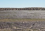 Pebbles seen from one angle (left) and from the other direction (right).
Jim’s 6WD tour vehicle broke down, repeatedly. Marine engineer Bill (one of the other tour guests) assisted in checking into the problem. He was suspicious of air getting into the fuel lines, but Jim assures us the vehicle just returned from being maintained.
Bill was also suspicious of the amount of fuel in the tank. The fuel gauge doesn’t work. However with a second fuel tank, we can change to that. Jim assures us we have plenty of fuel. You can see where this is headed, can’t you?
 Big Red is an 80 metre high sand dune 32 km west, on the road to Poeppel Corner (25 59S 138 00E), where Queensland, South Australia and the Northern Territory join. Big Red is merely the largest of over a thousand sand dunes that stretch across the Simpson desert. It is a major reason why we never tried to use our Hino 4WD truck based motor home on this route. Jim assured us his vehicle can eat Big Red. Jim was right. We climbed it with ease. (Photo left: Easy climb over Big Red.)
Then Jim said there is a much better view on a track down from the easy major crossing point. We bumped along a track for a few kilometres, looking at the birds in the scraggly desert scrub. Jim did find a much steeper spot for climbing the dune, and with a better view. We wandered around the top for a while, looking at the giant dune, and seeing dunes stretching out to the horizon. (Photo right: On top of “Big Red” dune.)
Eventually we walked back to Jim’s 6WD tour vehicle, right on the top of Big Red. Stranded on the top of the dune in fact. Seems neither tank had enough fuel. (Photo left: Jim’s 6WD stranded on top of Big Red.)
We tried phoning Birdsville. It is out of reach of any of our mobile phones. Even the CDMA can’t reach Birdsville. Jim has a HF transceiver in the 6WD. It has a broken antenna. It doesn’t seem to work either. Eventually some other visitors to the dune gave our tour leader a lift back to Birdsville.
While awaiting rescue, we entertained ourselves by watching a convoy of vehicles come along the track from across the desert. One after another they tried to climb the far side of the dune and failed. They eventually headed off for the lower crossing a few kilometres away. (Photo right: Track westward from Big Red.)
It got to dusk, and the desert was cooling rapidly. Artistic photos of sand dunes were getting a bit tired by then. Eventually a comfortable rescue vehicle arrived for us, and a mechanic and rescue vehicle (and fuel) for Jim and the 6WD.
We were in time for dinner, which was plentiful and delicious. We stayed overnight at the Pub.
Page last updated 26 December 2005
