
Map below is from Outback Spirit Tours website. It is a bit different from the tour we took, which did not include the flight to and from Cape Leveque shown here.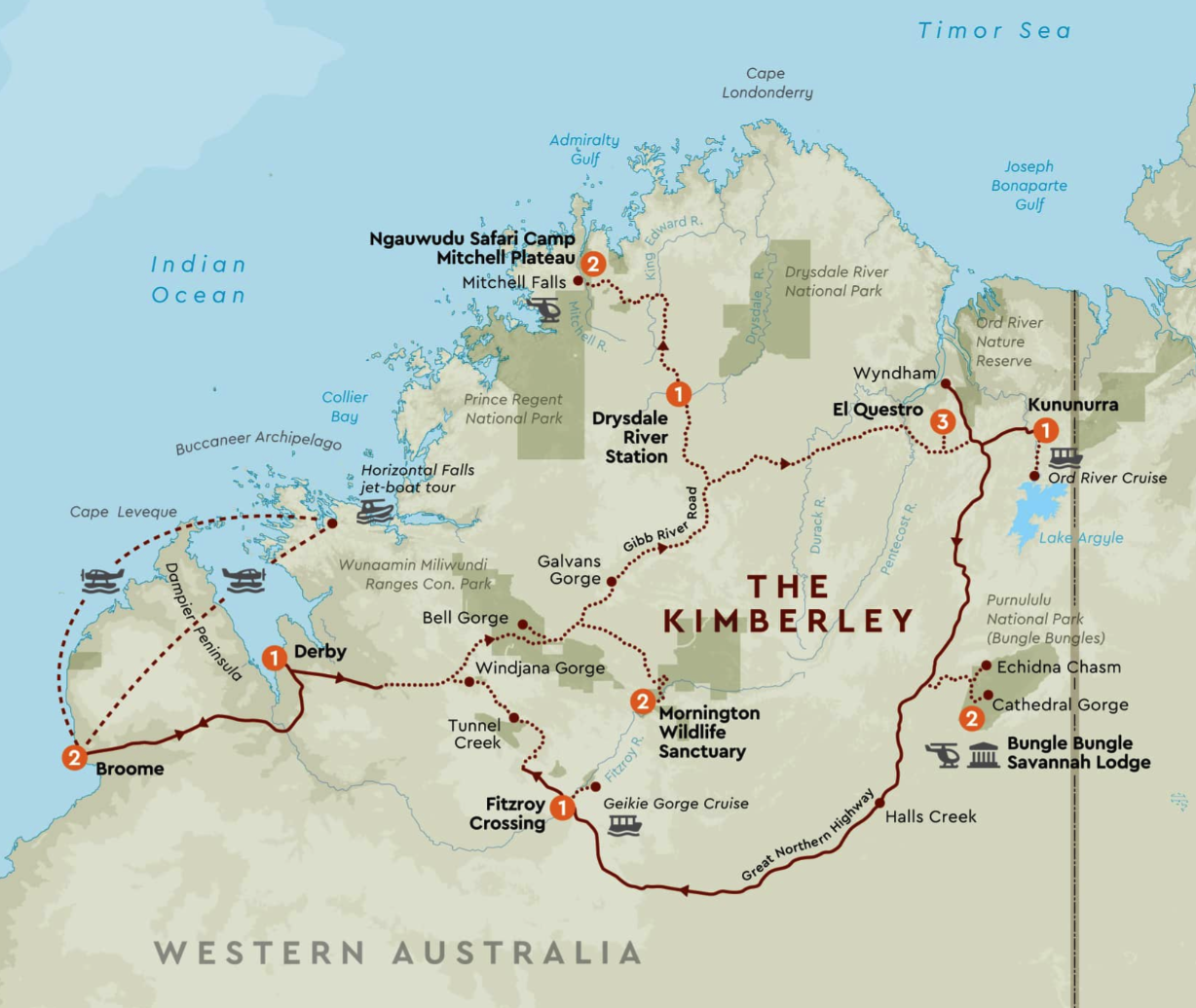
Part 1 of trip. Go to Part 3 of trip.
10 July. It was cold in the tent early in the morning, but the sun was up by 06:00 and we could roll open the tent covers.
Breakfast at 07:30 was bacon and some really nice scrambled eggs. We were surprised to see a double slot toaster. These are notoriously hard on solar power systems and their inverters.
Ecology tour with AWC guide Joey was a nice walk along Annie Creek, with Joey explaining what we were seeing in the Riparian zone. Joey was in his first year after University, and had done a season of volunteering with AWS previously.
By 11:36 we had driven back to the Gibb River Road and were headed further into the Kimberley. Stopped at Galvan’s Gorge (part of Mt Barnett Station) for a walk and scramble for swim and lunch. Very pleasant spot with a pool and small waterfall (running better this year than some, due to all the rain). Some rock paintings.
Mt Barnett Roadhouse for fuel. Pretty crossing at Barnett River. Lots of silt closed road after wet season.
Over often very rough road for 30 km into Mount Elizabeth cattle station, owned by Peter and Pat Lacy, where we would spend the night. Tiny young kangaroo one of five pets there. Lots of dogs. Afternoon tea.
Pat talked about their 6000 head of cattle, history of station, forthcoming lease issues and conditions, cattle concerns especially getting cattle out after the rainy season and the live export ban, restrictions on tourism, need to have five months of supplies on hand prior to the wet season.
Dinner was three courses, starting with a potato and leek soup, followed by a pork buffet with veggies. Sweets were self saucing chocolate pudding or a mango and passionfruit cheese cake. You sure eat well at these stations.
This was our least comfortable accommodation, with shared facilities and basic single beds. Not that we’re complaining, when the only other alternative for many kilometres would have been camping.
11 July. We left Mt Elizabeth at 07:15. The road out took 45 minutes to drive 30km. One particularly rough section threw half the bags from the racks on one side of the coach. We then put them all on the empty seats. We saw a dingo in the distance.
We drove past the entrance to Gibb River Station around 08:45. This is owned by one of the Aboriginal Land Councils,.
We saw a guy walking the road with two camels, the second of which had a tendency to walk sideways.
Turned off the Gibb River Road toward Kalumburu about 09:10. We got rid of our accumulated rubbish at the dump point there. The road north had been graded recently for part of the way, which means this was as good as it would get this season.
We had morning tea just after crossing one of the rivers, and a comfort stop at Drysdale River Station, where we planned to collect the already prepared lunches. What prepared lunches? There was a delay, which did not please Ian, who had phoned several times to organise the lunches. Drysdale seemed well maintained, at least as far as the grounds went. We got away around 10:50.
Originally we had planned a picnic lunch at Miners Pool on the Drysdale river. Running late, we passed this by and continued to the Mitchell Plateau turnoff. Soon after, we crossed the King Edward River.
One stop was to view aboriginal rock art. Ian knew two sites, so we had our lunch at the first site alongside the bus. This area only had a few items, but the contrast in styles was interesting.
Stop at King Edward River for a short walk to rock art gallery of Bradshaw and Wandjina rock art. Having now caught up on our schedule, we had another stop up a bumpy track to view another rock art site. This was much more extensive, and the path in had changed greatly since Ian had visited last.
This art site had a lot of different styles, including some black dancing figures, and kangaroos joined at the head. Some of us walked out by way of the old car parking area. The track could not be used by vehicles as it had ditches close to a metre deep.
The road in to Outback Spirit’s camp, Ngauwudu Safari Camp, is certainly exciting (=rough). We were met with cold drinks and shown to our safari tents. For the first time on the trip, staff brought our luggage around. It was obviously still a construction site, due to the late wet season. The kitchen had not been installed, so dinner was cooked on camp stoves and a campfire. The tables and chairs in the outdoor restaurant were there, so we didn’t have to balance our meals on our laps. It was a very enjoyable meal with good wine.
12 July featured one of the major highlights of the trip: a visit to Mitchell Falls. The 20 km drive to the starting point took 45 minutes. Eric took the walk, but Jean took a helicopter to the top.
Eric saw Little Merton Falls and Big Merton Falls. He walked under the falls to an Aboriginal rock art site, where the natural air conditioning of the falls thundered down just past where the group was gathered under the rock. More wading across creeks and clambering over rocks brought them to a spot on the other side of the falls from where the smaller group of us waited, then they crossed just above the falls and joined us.
Everyone took the helicopters back to the bus, which returned us to Pandanus Pavilion. There we discovered that the kitchen had been installed while we were out, and the appliances were connected and working. The staff were thrilled with the opportunity to show it off by producing a delicious roast lamb dinner.