May 2012 archive

Near Raft Point, Kimberley coast

Leeuwin II, near Raft Point

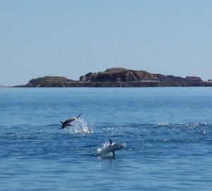
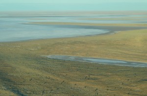
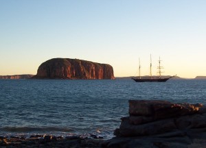
6 July 2006. After anchoring overnight near Raft Point, we rose early to discover the Leeuwin II, a 55-metre, 3-masted “tall ship”, nearby once again. We’d seen this ship once or twice earlier in the trip, and spotted it several more times before we reached Darwin; it had left Broome the day before us, and …

Continue reading

Yellowfin tuna, Kimberley Coast

Yellowfin tuna leaping

4 July 2006. Cruising along the west Kimberley coasst, we passed a group of yellowfin tuna leaping through a school of baitfish.

Siltstone sculptures, Kimberley Coast

Siltstone sculptures, Edeline Island

4 July 2006. Siltstone rock formation, Edeline Island, west Kimberley coast. We wandered around looking at the many and varied rock formations (eroded into fantastic shapes by wind and water) and the gravestones of divers: three unmarked, one with an inscription dated 1891.

Mitchell Falls, Kimberley, Western Australia

Jean at Mitchell Falls

12 July 2011. Mitchell Falls is one of the must-see features of the Kimberley region of Western Australia. The top photo is a view from the helicopter that took Jean to the top of the falls (and, later, back down again). The lower photo is taken from one of the many viewing areas along the …

Continue reading

Signs for Strzelecki Track, South Australia

Strzelecki Track signs, Lyndhurst

Leaving Lyndhurst, South Australia, heading for Innamincka along the Strzelecki Track, you get a reminder of the distances between places to buy fuel for your vehicle in some parts of the country. (Distances are in kilometres, of course.) This stretch is by no means the longest fuel-less drive one can take in Australia.

Lake Eyre, South Australia

Lake Eyre

4 June 2011. Lake Eyre is vast and mostly shallow. As it shrinks, it becomes increasingly saline.

Cooper Creek ferry crossing, South Australia

Cooper Creek car ferry crossing

The Cooper Creek runs a bit to the east of Lake Eyre and also carries water from Queensland. Usually it’s dry, but after a few wet seasons in a row, it will actually have water in it. This year it had so much water, the one road in the area (the famous Birdsville Track) was …

Continue reading

Warburton River, South Australia

Cooper Creek, South Australia

4 June 2011. When I first posted this picture, I thought it was the Cooper Creek, but it’s more likely the Warburton near Kalamurina.

Warburton River, bringing water to Lake Eyre

Warburton River, bringing water to Lake Eyre

The Warburton is one of the rivers bringing water south from Queensland to Lake Eyre. It winds in multiple channels through hundreds of kilometres of mostly flat countryside.

Lake Eyre, South Australia

Lake Eyre, South Australia

4 June 2011. Lake Eyre is normally a dry salt pan, but some years it (partially) fills with water drained from a huge catchment area in Queensland. We were privileged in 2001 to see the lake with water in it, again made a special effort to return in 2011 when the lake filled again. By …

Continue reading