This is a report on Jean’s cruise along the Kimberley coast of Western Australia, from Broome to Darwin (NT) in July 2006. Early in the year she read about the cruise in the Australian Geographic magazine. When Jean phoned to enquire about the trip, she was told that only one space was available, for a female to share a cabin with another woman. So Jean decided to go alone.
The cruise was organised by Aurora Expeditions and took place on the Coral Princess. You can read about next year’s Kimberley Cruises here.
All photos by Jean Weber unless otherwise noted. Click on a thumbnail image to see it larger. Note: not all thumbnails have larger files linked to them, and some file sizes are fairly large, so not recommended for people using dial-up connections.
Albums of photos from the trip — more than are shown on these pages.
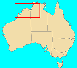 Maps are from Australia Unfolded, a CD from AUSLIG, 1999 (no longer available), with annotations by me.
On the map below, red lines are major roads (some unpaved); green line is the route of our expedition on the Coral Princess. Map shows elevations.
Google Maps reference for area shown below.

Legend: 1 Broome; 2 Cape Leveque; 3 Strickland Bay & Edeline Island; 4 Buccaneer Archipelago, Yampi Sound, Cockatoo & Koolan Islands; 5 Talbot Bay & horizontal waterfalls; 6 Melomys Island; 7 Raft Point; 8 Montgomery Reef; 9 Langii; 10 Kunmunya, Camden Harbour, Sheep Island, Port George IV; 11 St George Basin, King Cascade, Camp Creek; 12 Careening Bay; 13 Prince Frederick Harbour, Hunter River; 14 Mitchell Falls; 15 Bigge Island; 16 Sterna Island; 17 Cape Londonderry; 18 King George Falls, Tranquil Bay; 19 Byrnoe Harbour, Bare Sand Island; 20 Darwin.
Prologue — Sydney and Broome
The trip started on Thursday, 29 June, when Eric and I flew to Sydney. Friday we ran errands, and on Saturday I flew to Broome, staying at the Broome Motel not far from the Chinatown area. On Friday I wandered around Broome and walked out to Town Beach, stopping on the way back at Matso’s (micro brewery) for a refreshing lager (“River Rocks” — they were temporarily out of the one I’d had last trip, “Monsoonal Blonde”).
Then I sought out an Internet cafe. There were 3 within an easy walk of the motel, but only one of those (Galactica DMZ, 2 Hamersley St) was open late Sunday afternoon. It was a large room on the first floor of a building near the new Sun Cinemas, and featured a huge TV (showing some action movie), comfy couches, places for people to use their own laptops, and a great many computers, each with a comfortable office-type chair to sit in. I was able to deal with my mail in relative comfort, other than putting up with the noise of the movie and a few kids… but noise is to be expected in an Internet cafe, so I managed to ignore it.
On Monday I had to check out of the motel by 10AM, but we were not due at the ship until late afternoon, so after doing my laundry (and discovering that the dryer didn’t), I packed, checked out, left my luggage at the motel, and wandered off again. Here is a map of Broome.
This time I tried a different Internet cafe (Internet Outpost, 16 Carnarvon St), a small one near the tour-bus parking area in Chinatown. It was quieter but had canvas “director’s” chairs which put the desk surface at an uncomfortable height, so was not a very comfortable place to work. Then I caught the bus to Cable Beach, where I discovered there was no place to sit except on the grass, or on the beach, or at the cafe (where, of course, they would look unkindly upon people eating lunches they had not purchased there). I found a patch of shady grass and read for awhile, then caught the bus back to Chinatown. Here is the Cable Beach webcam site: BroomeCam.
Eventually it was time to go to the motel, collect my luggage, and wait to be picked up by the bus taking people to the wharf to join the boat.
Day 1 — Broome to Cape Leveque (Monday 3 July)
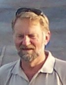 At the wharf, we were greeted by our two guest lecturers: Chris Done and Len Zell. I had worked with Len 30 years ago at the Australian Institute of Marine Science in Townsville, and wondered if he would remember me. As I boarded, he took one look at me and said, “It IS you!”
Len Zell (photo right) is a well-known professional photographer, and has given me permission to use a few of his photos from the trip in this report. Do check his websites, http://www.lenzell.com/ and http://www.wilddiscovery.com/. I recommend his book A Guide to the Kimberley Coast. Not only are the photos stunning, but the commentary is most informative. If you want to learn more about the places we visited on this trip, this is the book to read.
 As we set off from Broome, the expedition leader, Mike Cusack (photo left), welcomed us and formally introduced Chris and Len and the rest of the crew. We had the obligatory safety briefing, complete with practice in putting on a life jacket.
 In 1987, Australian Geographic chose Mike and his wife Susan from 500 other couples to spend a year living in isolation in the wild and remote Kunmunya area of the west Kimberley. Mike now works as a Ranger with Parks Victoria in the Grasslands Unit, Basalt Plains District. He is also actively involved with Parks Victoria’s Environmental Management Group, Geographic Information Systems (GIS) and fire ecology.
Chris Done
(photo right) was the Regional Manager for WA’s CALM (Conservation and Land Management) and has explored much of the area as a land manager for nearly 30 years.
Our first dinner onboard was a sumptuous array of seafood (smoked salmon, oysters, prawns, crab, Moreton Bay bugs, fish) and salads.
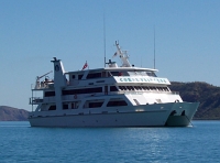
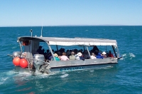 Photo left: Coral Princess, our comfortable cruise boat.
Photo right: Explorer, the flat-bottomed boat used for shallow water and tight spaces. When not in use, this boat was on a rack at the back of the Coral Princess, raised well above the water level. This rack made loading and unloading passengers between the Coral Princess and the Explorer so very easy — no climbing up and down ladders! The Coral Princess also carried two Zodiaks (inflatables) which were used for some excursions, as we’ll see later. Passengers boarded the Zodiaks from the Explorer — again, no ladders. Very nice.
Day 2 — Strickland Bay and Yampi Sound (Tuesday 4 July)
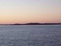
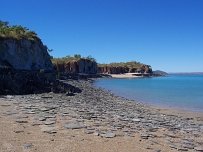 I got up just before dawn, as did several others, and found that we were just passing Cape Leveque on the tip of Dampier Peninsula. The flashing lighthouse was quite visible. Eric and I had flown into Cape Leveque on last year’s air tour, so it was interesting to see it from the seaside. (Map reference 2.)
After a hearty breakfast, we attended an “introduction to the Kimberley” talk, during which we crossed the mouth of King Sound and reached Strickland Bay. After an equally hearty lunch, we set off in the Explorer and landed at Edeline Island to view the beach and siltstone rock formations. Len and Chris explained the geology of what we were seeing, and we wandered around looking at the rock formations and the gravestones of divers: three unmarked, one with an inscription (dated 1891). (Map reference 3.)
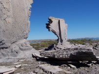
 Photos left and right: some of the siltstone “sculptures” on Edeline Island. We continued northeast past an area known as “The Graveyard”, where many pearl divers perished due to treacherous currents or the “bends” (nitrogen narcosis). Then on to the Whirlpool Passage, a channel that funnels the tides into whirlpools. Tides along this coast are extreme, up to 9 metres, and can get quite treacherous, especially in narrow areas.
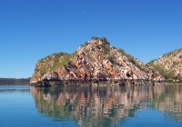
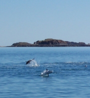 Along the way we saw some very interesting tilting of ancient sandstone rock, and a group of yellowfin tuna leaping through a school of baitfish.
I took some photos of the Whirlpool Passage, but they don’t convey the sensation of being whirled around by the water as we were. (You had to be there!) I would not enjoy doing that in a sailboat, although it was fun in the Explorer.
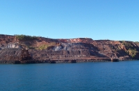 Back aboard the Coral Princess, we headed for Yampi Sound, passing Cockatoo Island (an iron mine that has recently been reopened — one of the few signs of modern life we’ll see on the trip) and anchored at Nares Point for the night. (Map Reference 4.)
The Captain’s Welcome Aboard party was held at sunset on the Sun Deck. Many people dressed up; others didn’t. Nice group.
Day 3 — Talbot Bay, horizontal waterfalls, Melomys Island (Wednesday 5 July)
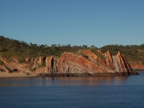
 Before dawn, Coral Princess began making its way east along The Canal, the stretch of water between Koolan Island (another iron mine) and the mainland. Nothing like the sound of the anchor being raised and the engines starting up to roust lazy passengers from their slumber! We went through “The Gutter” (the narrowest point along this passage), where we passed a long stretch of Paspaley pearl farms, with their living quarters for the staff. (Map reference 4.)
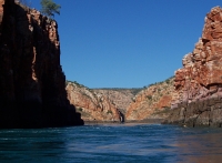
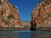 After breakfast we took the Explorer into Talbot Bay, to the so-called “horizontal waterfalls”. (Map reference 5.) Here are two views taken by me from the boat. Photo left: Looking through first gap; second gap visible in distance. Photo right: Zodiak going through second gap. For an aerial view of the area, with the second gap in the foreground, see last year’s air trip.
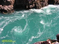
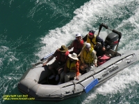
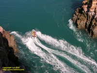 Photos left, right and below are Copyright 2006 Len Zell.
Not surprisingly, there were several tourist boats and seaplanes in the area, as it is a popular spot for tours out of Broome and Derby.
For our visit, the difference in high and low tides was only 3 metres (it can be up to 9 metres), so the experience was exciting, but not terrifying.
 There are two narrow gaps between islands in this area, where tidal flow compresses the water so much that it is much higher on one side of the gap than on the other, creating a “waterfall” effect as the water passes through the gap.
We passed through the first (wider) gap in the Explorer, then took turns going through the second, narrower gap in the Zodiaks. Meanwhile, Len had climbed to a high point on one of the islands and was taking photos of all the fun. As a finale, the Zodiaks and Explorer exited the wider gap in convoy.
After lunch and an illustrated talk on the geology and landforms of the Kimberley, we took the Explorer to Melomys Island, the smallest of the Kingfisher Islands. Melomys is one of the genuses of the mosaic-tailed rats. The Grasslands Melomys (M. burtoni) found here is one of the arboreal tree-rat group living in tropical forests across northern Australia.
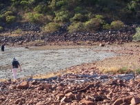
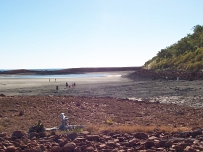 We didn’t see any of the rats, but we did get a good look at the beach and the almost dry lagoon beyond it. Lots of tracks (birds, rats, crabs) were visible in the dry mud of the lagoon. The stony outer wall of the lagoon had areas almost like concrete. There were also some human stone constructions, probably fish traps. (Map reference 6.)
Page last updated 19 May 2007.
