Airlie Beach, Qld to Katherine, NT (12 days)
For the past four or five years we had been attempting to get away in winter for a driving tour around Australia. Each time we started, something went wrong, including a death in the family, plus the multiple mechanical problems with the motorhome reported in previous newsletters. We also usually had prior commitments that ensured we started late in winter.
This time we have a new car, Jean’s Subaru Forester, and no prior commitments. We are also starting far earlier than ever before, only a few days into winter.
So were there problems? Packing a quart in a pint bottle, of course. An unseasonable cyclone in the Indian Ocean brought late rain across northern and inland Australia, and thus potential flooding outside the rainy season.
Photo albums from the trip (more photos than shown on this page): Days 1–3, Days 4–5, Days 5–11, Days 12–14. Other albums listed on later pages of this trip report.
These notes were written by Eric and occasionally amended by Jean. Eric took some of the photos and Jean took others. All photos were selected, cropped, and inserted into this file by Jean. Factual information was taken from various sources including tourist brochures; we do not guarantee its accuracy.
Click on a photo to see a full size version. Not recommended for readers on dialup connections—some of these files are between 1 and 2 MB.
Day 1, Airlie Beach to Charters Towers, Saturday 5 June 2004
Leaving Airlie Beach, latitude 20.15S, longitude 148.43E (map ref. 1). The first day of driving north is on the Bruce Highway, the main road. A good road, one lane each way, mostly through lush coastal fields of sugar cane. Very familiar to us from trips to Townsville. We refuelled a little before midday, when we passed Bowen. We expected that might be the last time we saw fuel at less than $1 a litre.
We stopped as usual at Inkerman for lunch. A little later at Ayr we noticed the indigenous opening ceremony was being held in the park with the giant snake. Looked like lots of people attending. We were pleased to have had a chance to view it on a previous trip before it became better known.
About 40 km from Townsville, we turned off the main highway and took the back road to Woodstock. No rock music, just a road that sometimes dropped to a single lane of bitumen. The 30 km stretch has about 6 bridges that are under water when it gets too wet. The road reports suggest delays then of between 12 and 48 hours. However this road lets us avoid going into Townsville, and cuts a lot of kilometres off by the time you join the main road west, the Flinders Highway, and the road was open all the way. We noticed carefully tended farms along the back road, mostly stocked with what appeared to be macadamia nut trees.
We stopped at a service station after a good run up the great dividing range (here little more than low hills) in a 110kph zone. This is road train territory, as are most of the rest of the places we will reach once away from the coast. We soon got stuck behind a three-trailer road train. The countryside varied from native trees to scrubby grassland, some still dry looking despite being relatively close to the coast.
We stopped pretty early for the day, since we wanted an easy first day. We’d been hoping to push through to Torrens Creek, but Charters Towers gave a much wider range of motels (that is, more than one). Charters Towers (latitude 20.04S, longitude 146.15E, map ref. 2) is 135 kilometers inland southwest from Townsville, on the Overlander’s Way.
We settled into Charters Towers Motel, near the junction of the Lynd and Flinders Highways. The motel room had a tiny fridge and a microwave oven, plus the usual tea making facilities, airconditioning and a ceiling fan.
After unpacking, we walked the half km to the shopping areas of the town. We always try to get a little walk in several times a day, and usually fail unless we need to walk to the shops.
There was a pretty park with a modern fountain, and a restored rotunda. Several of the older hotels had been restored and changed to restaurants for modern motels adjoining the old hotels. The Park Hotel (opposite the park) had a large sign offering discounts for seniors. Had we noticed that before checking into the other place, we might have stayed there instead.
Charters Towers was once the second largest town in Queensland, back in the gold rush days of the 1880’s, and even had its own stock exchange in the nearly square mile of city centre. Cattle country now, although there is still some highly mechanised mining for the last of the economical gold and other minerals, plus tourism.
Most country towns roll up the sidewalks well before 5PM on a weekend. Luckily a Fresh Express was open for items like milk for our breakfast. At the very pretty main street, with its restored buildings, we found a Red Rooster (an Australian francise somewhat like KFC), where Jean discovered she could get a Seniors discount on the half chicken that made up most of our evening meal. She likes having a discount card, but we often forget discounts might be available.
We walked back to the motel past attractive renovated buildings housing police, post office and tourist information. The local council office was a modern open construction with an arch leading through to the main areas.
Day 2, Charters Towers to Julia Creek, Sunday 6 June 2004
Jean tried the Charter Towers motel phone, but her computer couldn’t connect via it. This isn’t an unusual problem with motel switchboards, especially in motels with a digital phone system. Jean had to use her CDMA mobile (cell) phone to collect her email.
As we drove along the Flinders Highway, we saw more bicycles with panniers, and I marvelled as always at the people who would attempt long distance rides.
There were gentle rolling hills with low scrub and what looked like small gidgee trees. Outside Charters Towers the Flinders Highway was excellent, and zoned for 110kph. Once out of the hills near town, we had a dead straight stretch of road alongside the railway, disappearing into the horizon.
We stopped an hour down the road at a rest area for a midmorning snack from our cooler. We were a little surprised to find that the rest area actually had a toilet block. Mostly they are just a place to pull off, with maybe a picnic table.
The road takes you through small towns with names like Balfes Creek (pop 12), where the railhead once was in 1884. Past the turnoff to Thalanga Mine, then Homestead (pop 100), Pentland (pop 300), established by the railway in 1884. Another stop for photos was at Burra Range lookout, near the peak of the Great Dividing Range, at an altitude of a little over 500 metres.

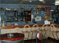 We also stopped at the Exchange pub (ph 07 4741 7342) at Torrens Creek (pop 18) where we had stopped twice before when in the motorhome. We found they had 9 hotel rooms upstairs and 5 motel units. The owners, Les and Denise Newland, told us it is up for sale, and they were planning to move to Bloomsbury. Best graffiti was encountered there: “Australians think 100 years is a long time, Europeans think 100 kilometres is a long distance.”
Grass plains, passing the start of the longest fence in the world, the dingo fence, which goes to South Australia. The Flinders grass was looking drier and drier as we passed through Prairie (pop 50), once a Cobb and Co stop before the railway came in 1884.
Once past the Great Dividing Range, you are in one of the flatest, oldest lands. Although only a few hundred kilometres inland, from this point pretty much all the rainfall in Queensland flows sluggishly inland, to Coopers Creek and if it hasn’t evaporated, to Lake Eyre. None of the water flows to the sea. The water flow is slow, with land slopes of as little as six inches per mile, so rainwater can take the best part of a year to make its way down to Lake Eyre.
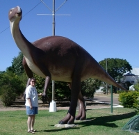 We stopped at Hughenden (map ref. 3) for fuel, lunch, and taking some dinosaur photos. Lots of photos of Jean with weird giant animals, like Hughie the Mattaburrasaurus. One of the tourist revival themes here comes from the various dinosaur bones found in the area. Hughenden is typical of the larger towns in the area, with a population around 700.
We continued on to Richmond (map ref. 4), on the Flinders, the longest river in Queensland. The shire has an area of about 27,000 square kilometres, about the size of Belgium. The town has a population of about 1000. It was originally a gold rush town, with 12 hotels. Then a sheep and cattle town, with the old Cobb and Co coaches, before the railway came through. Like most towns inland, Richmond depends on artesian water, with the first bore sunk in 1900.
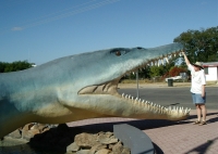
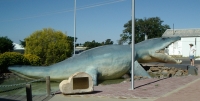 We took a look at the Kronosaurus Korner fossil museum, and got more photos of Jean with dinosaur models.
We continued through ever flatter, ever drier mostly treeless country, covered in yellow Mitchell and Flinders grasses. A 360 degree view to the horizon in all directions. with only the road and the rail track to show human had ever been here.
We stayed the night at Julia Creek (latitude 20.39S longitude 141.44E, map ref. 5), after a bit of a walk around the town (population of the area about 500). The pub had new motel units behind it. Nothing was open in town on a Sunday, of course, but the pub had a roast pork and vegetable meal available, and by then the temperature was down a little. A big feature of the town is the bi-annual Dirt and Dust Festival, which I guess says something. An associated event is the Kynuna surf carnival (no surf anywhere near that town of 18 people).
Despite it being winter, the outside temperature was about 32 degrees C for much of the day.
Day 3, Julia Creek to Camooweal, Monday 7 June 2004
We set off from Julia Creek around 8:30, after paying for our phone calls. Luckily the Telstra Big Pond ISP number is a local call throughout Australia. Jean also had a phone card (Say G-Day, one of numerous cards available from a range of companies, sold in most newsagents, Post Shops, and various other stores) for calling her mother in the USA, so that also wasn’t a problem.
The dead straight road took us through a flat terrain covered in yellow Mitchell grass. Every ten or so kilometres you might sight a farmhouse.
Cloncurry (pop about 4000) was our next town (map ref. 6). We had been through before, and it is a handy historic town with a good range of modern facilities, and some real Art Deco buildings like the Shire Hall and Library complex. It also has the dubious distinction of recording Australia’s highest temperature in 1889 (53.1C or 127.5F). Perhaps appropriately, it is also known for being the birthplace of the Royal Flying Doctor Service.
We knew where the Woolworths supermarket was here, so we searched for a few breakfast items we hadn’t been able to get before leaving home. We couldn’t find enough to buy to spend the $30 required to get a 4-cent-a-litre discount on fuel.
Between Cloncurry and the major mining town of Mt Isa on the Barkly Highway the country got hilly and much more interesting. There had obviously been recent rain, so there was a lot more greenery than usual.
We had originally planned to reach Mt Isa in two days, but our late start made that difficult. We had thought to have a rest day there, and perhaps check out a mine tour.
Instead we stopped at the Riversleigh fossil museum in central Mt Isa (map ref. 7) for lunch, followed by a museum tour. We had seen the D field at Riversleigh last year, but the museum places the fossils in more of a context. It also make it a lot easier to see them. We enjoyed the museum. It had some well done walkthrough dioramas. The film of extracting the fossils was a little out of focus, and the sound seemed muddy. Despite this it did help somewhat when we were actually in the fossil laboratory tour.
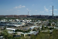 We visited the lookout above town, and got a fine panorama of the town, although naturally a quarter of the horizon is dominated by the mine.
After the tour we decided to continue on to Camooweal for the night. Once past there towns are scarce, and not reaching Camooweal would make driving distances too much for us for comfort on the next leg. Also, we figured we would often be passing through Mt Isa.
There was a lot of road construction taking place, following the late close of the wet season. We stopped for photos at a rest area between Mt Isa and Camooweal, commemorating the WWII road construction. Once past the construction zone the road conditions were more interesting, although not single lane (unless the other vehicle was a road train, in which case you get out of their way).
We reached Camooweal (latitude 19.55S, longitude 138.07E, map. ref. 8) around 4:30, somewhat later than our usual stopping time, and got the last of the six motel rooms at the Shell service station. This is nearly 200 km from Mt Isa, and well over 400km from Tennant Creek in the other direction, so it is often the first or last chance to take a break from driving. It is also only 12 km from the Northern Territory border. so we were finally leaving our home state. We took a walk around the town, which didn’t take real long, given the population of the area is about 250.
We went down the road to the Post Office Hotel for our evening meal. It was noisy and friendly, and the meat in the steak sandwich was still stringy. They came with chips (fries), and despit his diet Eric ate the chips. This hotel camping area was where we had stayed in the truck when passing through two years ago, but it was much larger now.
Day 4, Camooweal to Renner Springs, Tuesday 8 June 2004
We got away from Camooweal around 8AM after refuelling, since there is only one (expensive) fuel stop before the Stuart Highway, and places do run out of fuel out here.
We crossed the new bridge across the Georgina River just outside town. This bridge was being built when we were through two years ago. Now it stands high above the old low level bridge. The angle of the sun was such that we couldn’t get a decent photo.
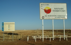 Northern Territory
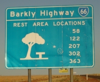 We stopped at the Northern Territory border to photograph the signs and turn our clocks back half an hour. There isn’t much else to see in this tableland, unless you come across an eagle squatting at a roadkill carcass.
About 65 km along the road we reached Avon Downs, an isolated police station in the middle of nowhere. There was a parking area, with a brand new pit toilet, replacing the dilapidated one we saw two years ago. The Territory government had a driver reviver station, an electric urn on a table, with tea, coffee and sugar. Bring your own mug. Plus the often present donation box for the Royal Flying Doctor service. No milk in evidence.
The next rest area was after Soudan station, another 65km along, past the Rankin River.
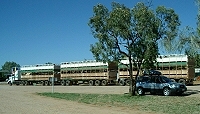
 We reached Barkly Homestead (map ref. 9), 1600 km from home, before 11. We each had a chicken and salad sandwich too large to hold. Great prices too. Jean was keen to get some photographs of road trains, as they are larger in the Northern Territory than in any other state.
The road was pretty boring, and we stopped at each and every one of them—the bores, that is. At 41 Mile bore Eric recorded the mournful screeching sound of the windmill. By then we were only 70 km east of the Threeways, where we intercept the Stuart Highway, the main-north south road between Adelaide and Darwin. We had to refuel at Threeways (map ref. 10), at $1.31.5 a litre (that is A$4.98 a US gallon, or US$3.50).
We decided to skip backtracking 35 km to Tennant Creek (pop 4000) for the evening, as it was only a little after 1 p.m. Instead we headed north on the Stuart Highway to Renner Springs.
The countryside was lush and green, unlike any other time we’ve been through. The recent unseasonable rain the centre had really made a difference, and the desert was blooming.
There was one small plateau formation called Lubra’s Lookout along the roadside, where tribal women were said to watch the approach of tribes from a considerable distance.
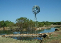 Renner Springs (latitude 18.19S, longitude 133.48E, map ref. 11) is a little oasis on the Stuart Highway, in the Ashburton Ranges. A natural spring, a small lagoon, and bird life. Nothing else is around. We reached it a little before 3 p.m., giving us an easy following day. The place was named after Dr Frederick Renner, who tended to workers on the Overland Telegraph line, who noticed a variety of bird life and found the spring that drew them.
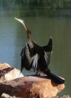 We didn’t see a great variety of bird life during our walks around the spring. A darter drying its feathers (see photo at right). The usual geese, who aren’t native. Still, it was a pretty place to stop for the day.
We had steak sandwiches again for dinner. This time we ordered them with salad, and got a giant meal out of it. Pretty typical for country pub meals.
Day 5, Renner Springs to Mataranka, Wednesday 9 June 2004
We awoke at dawn, to a chorus of bird cries, however the loudest was a pretty standard rooster, nothing exotic at all.
By the time we were ready to leave at 8AM, everyone else had already left, often long before.
We came upon a light plane parked alongside the main road, probably waiting to use the road as a runway. Not unusual in more remote areas.
We stopped at Elliott (Kulumindini to the Jingili people), the next town along. The outskirts seemed devoted to a dead car dump. It had at least three service stations, and the big feature is a 9 hole golf course. The town was developed during WWII, as No 7 Australian Personnel staging area for 1500 men on the third day of the run up from Alice Springs, and was named after Captain R.D. (Snow) Elliott. We didn’t stop a little further along at historic Newcastle Waters, as there is basically nothing there except the 1936 museum and we’d been here before.
One of the scenes Jean wanted to collect on photo was a road train. Not just any road train, but the supersize four trailer variety. We found one at Dunmarra roadhouse. Near here is a tree with an S for Stuart carved in it. This was where Stuart’s expedition found the water that saved them. Dunmarra is reputed to be named for Dan O’Mara, whose body was never found.
We stopped for lunch at HiWay Inn near Daly Waters (map ref. 12), wanting to see how the new owners of two years ago had developed it. Pretty impressive. We can report the chicken and salad sandwiches are still large.
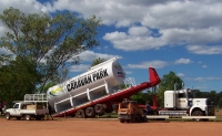 While we were there, a large tilt loader arrived with a giant diesel fuel tank. This was unloaded by sliding it onto a concrete slab, while we watched and photographed it. This reminded us we needed fuel, only $1.27 a litre this time.
We didn’t stop this time at historic 1938 Daly Waters pub, as we had visited there by motorhome in 2002 and flown into the disused ex-Qantas airfield in 2003 and had lunch at the pub. This tiny, isolated spot, not used by commercial aircraft since 1965, was once Australia’s first international airfield.
Further up the road, the caravan park and store at Larrima looked much the same, still with the large alligator out front. There is a free museum nearby, as well as the historic pub that was once a WWII officer’s mess across the road.
On the way into Mataranka we diverted to the old Elsey homestead graveyard, to photograph the graves of the real historical people who became the characters in Jeannie Gunn’s We of the Never Never.
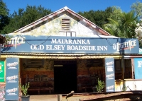
 We stopped around 3 p.m. for the evening at Mataranka (pop 250, latitude 14.54S, longitude 133.05E, map ref. 13), at Bruce Ross’s very small Mataranka Cabins (ph 08 8975 4838) camping area on on his farm and orchard on the Little Roper River, on a old WWII army site. This is very near Bitter Spring, a part of the Elsey National Park. Mataranka Cabins had a total of two self contained cabins. This seemed a sufficiently rustic site for us, so we booked into one of the cabins. I’ll add that they had air conditioning, a microwave, a TV and radio, a hotplate, ensuite, and a nice verandah. Like most of the country accommodation, what they lacked was a phone connection for the internet!
 As soon as we had unpacked, we rushed the three kilometres back into Mataranka to try to get a dinner. I had been lusting after one of the great meat pies we had two years ago. However we were told the place making them had fallen upon hard times. I figured everthing closed at 5, but there was a supermarket, so we got some frozen dinners (chicken kiev), for lack of anything else. We got some crackers to go with the brie we had in our cooler, and figured this would be a good place to open the bottle of Clancy’s red we were carrying.
Back at the cabins we changed into swimming costumes and walked into the National Park. About a half kilometre brought us to Bitter Spring. Although it is winter, being at 14 degrees south means the days are still warm, peaking at about 32 degrees C. The natural spring water was about bath temperature, and was very pleasant, although you had to keep swimming against the current to avoid being swept a few hundred metres downstream to the next access point. That I wouldn’t mind, but the walk back barefoot over sharp stones I could do without.
Day 6, Mataranka, Thursday 10 June 2004
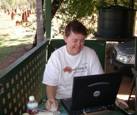 Jean’s email messages included one from a publisher offering a contract on a new book. That involved working to a very close deadline, in only a few weeks. Since she didn’t need internet access except for email, we decided she could work best in an isolated place like Mataranka. One other option was to waste a day or more driving to Darwin, where we could get internet access, but where there were a lot of distractions. So we booked the cabin through to Tuesday morning, in the hope Jean could get most of the new book revised by then. (She did.)
The Rural Transaction Centre (a government initiative to provide services to small towns like Mataranka, population 250) desk person told Eric that they had internet available via satellite at $2 for 15 minutes. Eric checked the room, which seemed to have a bunch of RJ45 ethernet sockets, as well as their own computers. He asked about using our own laptops, but the desk person didn’t know how we would do it, but raised no objection to us trying when we were next in with our computers.
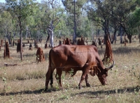 While Jean worked, Eric sat out on the balcony and watched the cattle going home. Watched large predator-type birds in a nearby nest. Watched insects, like the emerald green flying bug that inspected us several days in a row. Watched agile wallabies crossing the road to reach the water. Admired the many giant termite mounds.
Each day when Jean finished work we walked down to Bitter Springs and went swimming at round 4 p.m.
Day 7, Mataranka, Friday 11 June 2004
 When Eric tried to use his laptop at the Rural Transaction Agency he was told by a (different) staff member that he coudn’t possibly do that. Couldn’t even try it. The staff member seemed deathly afraid of computers, and in fear something would break. So that was a dead loss. We can’t really blame staff for being afraid to let us use our own computers. They can’t really be expected to understand whether it will harm their network. However it is decidedly annoying.
Trying to get reasonable internet access via your own computer in country Australia is not easy, if you can’t get your hands on a standard analog phone line. When you have CDMA phone access you can use the cell phone, but that is both slow and expensive. GSM cell phones would also be fine, if they worked away from major towns, but they don’t in Queensland or the Northern Territory. Anyway they are just as expensive as CDMA and even slower.
For dinner we headed to Mataranka Homestead, about 10 km away near the splendid Mataranka thermal pool, where we had stayed several years ago. Unfortunately, they had an obvious bat (flying fox) problem this time. The smaller kitchen was closed as usual for the evening, and the menu in the main dining area didn’t thrill us, and we couldn’t get take away to evade the smell of the bats. We left.
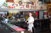
We went on to Territory Manor, a larger caravan park in town. They had an excellent barramundi meal available. A slab of barra large enough that Jean coudn’t finish eating it (not after all the salad she ate). That was pretty good stuff, although service was a bit slow (but very cheerful). We didn’t manage to see them feeding their barramundi.
Days 8, 9, 10, Mataranka, Saturday-Monday 12-14 June 2004
Much as previous days. Jean working furiously over a hot keyboard. The search for food continues. The Stockyard Gallery gave by far the best results, with chicken and salad sandwiches. Eric went out at various times to take photographs with different light angles.
Day 11, Mataranka to Katherine, Tuesday 15 June 2004
Leaving Mataranka, we headed back south briefly, for the 12 km drive to the Roper River. This led us through a half dozen or so minor water hazards, where the high water table had left the road flooded after minor rain. We did eventually get to Roper River, and saw the river cruise boat used for the afternoon tours. Some more adventurous people were canoeing.
We also stopped at the Stockyard Gallery in Mataranka so Jean could see the range of aboriginal art available.
Then we finally headed north again for the short drive to Katherine. We didn’t stop at Cutta Cutta Caves, as we had seen these tropical caves on a previous trip.
We needed to stay in Katherine (pop 11,000, latitude 14.28S, longitude 133.17E, map ref. 14) as this was where we could get a motel room with a phone. We stayed at the Mercure, just out of town, and it was very comfortable. Eric was suffering from a cold, and spent most of the next two days reading and sleeping.
Day 12, Katherine, Wednesday 16 June 2004

 The Katherine area was first used by the Jawoyn and Dagoman people, whose territory includes the Nitmiluk (Katherine Gorge) National Park we visited in 2002. Ludwig Leichhardt came through in his 1844 expedition, but the river was named after his daughter Catherine by explorer John McDowell Stuart in 1862. Like many towns along the Stuart highway, it developed after the Overland Telegraph came through at Knott’s Crossing. At 11,000 people, Katherine is the third largest town in the Northern Territory.
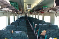
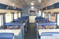 Jean managed to send her revised book off to the publisher, so she went off to see the Ghan during its four-hour stop at the new Katherine railway station. She managed to talk her way onboard, and take photographs inside several of the dining and lounge cars. The train is typically over 1 kilometre long, with over 40 passenger cars, various other cars (including lounge bars and restaurants), and several cars carrying automobiles (very good value for people in the Gold Kangaroo class). The train has two classes of passenger accommodation: Gold Kangaroo (private compartments with beds) and Red Kangaroo (sleeper seats). Jean was unable to see any of the Gold Kangaroo compartments because they were all in use. She was also unable to get a good photo of the train as a whole, due to its extreme length.
We’d now reached the point where we abandoned our trip in 2002. Tomorrow we’ll set off into new territory, heading west again.
