(Click on photographs to see a larger version. Note: Some file sizes are quite large; not recommended for people using a dial-up connection.)
Monday 15 August 2005 – Beverley Springs to Darwin via Bungle Bungles
Beverley Springs (Charnley River Station) (S16 44.0 E125 26.0) -> Halls Creek (S18 14.0 E127 40.2) -> overfly Bungle Bungles (S17 30.0 E128 30.0) -> overfly Lake Argyle diamond mine (S16 38.2 E128 27.1) -> Kununurra (S15 46.7 E128 42.4) -> Darwin (S12 24.88 E130 52.60)
After a relaxed start from Charnley River, we had a fuel stop at Halls Creek (Yarliyil) in a little over an hour. Got a good aerial view of the place as we came in to land. It certainly isn’t all that large. When we were in Halls Creek in 2004 we were astonished to find both CDMA and GSM phone access. There were some strange bushes planted around the tiny shelter area at the airport, plus small monoliths protecting the bushes. (Photo left: Halls Creek from air; right: Halls Creek airport.)
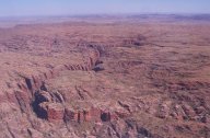
We overflew the Bungle Bungles (Purnululu). Partly due to the heavy tourist air traffic in the area, we didn’t get as low as we might like, but we could clearly see and overfly the characteristic beehive domes.
 The remote Bungle Bungle massif has been part of the World Heritage listed (2003) Purnululu National Park (209,000 hectares) since 1987. Prior to that it had aboriginal cultural significance to the Kija people, but was largely unknown to those outside the area. The Bungle Bungle name is said to be a corruption, referring to the Aboriginal name for local bundle bundle grass. (Photos left and right: Purnululu National Park, aka Bungle Bungles.)
The range was formed from sand and gravel deposited 360 million years ago in the Devonian period by rivers flowing from the northeast. Prevailing southeasterly winds helped form sand dunes, and eventually (over 60 million years) formed sandstone seven kilometres deep. Uplift and mountain building raised the sandstone into a flat surface 600 metres above the present sea level.
 Then erosion over the past 20 million years exposed the alternating several metre wide tiger stripes we see today. The dark bands where moisture was present contain cyanobacteria (blue green algae) which help protect the sandstone from erosion. The orange bands contain iron oxide, which also forms a protective film over the soft sandstone. The orange layers apparently dried out too quickly for the cyanobacteria to grow. (Photo right: Purnululu National Park, aka Bungle Bungles.)
The park contains a number of unique plants, including the Livistonia or Fan Palm, seen clinging to crevices within the range. We also noted many boab trees, especially along water courses.
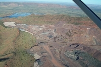
 We also overflew the massive Argyle diamond mine main pit and workings. This open-cut site is now almost exhausted, and is expected to run out in 2007. There is an experimental shaft deep under the site, as the mine tests to see whether deeper mining is justified. Argyle are covering the exposed and mined areas with rock, and re-vegetating the entire area. (Photo left: Argyle Diamond Mine.)
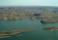
 We flew over Lake Argyle, which covers 1000 sq km. It is a bit of a pity so many interesting geological formations have disappeared under the waters of the largest constructed lake in the southern hemisphere. Lake Argyle is so large that it is considered an inland sea, and is the eighth largest artificial lake in the world. (Photo right: Lake Argyle.)
The Ord River dam is an impressive 335 metres long, and 98 metres high. The small 30 megawatt hydro electric power station at Lake Argyle now also supplies the Ord River irrigation area support town of Kununurra, which we were surprised to learn had a population of around 7,000 people. The population of Kununurra approximately doubles during the tourist and fruit-picking season. The same hydroelectric plant supplies the Argyle diamond mine, and also Wyndham, from its 220 gigawatt hour annual output. These sites all used diesel power plants until relatively recently, although the hydroelectric plant was installed when the dam was built to supply the Ord Irrigation area.

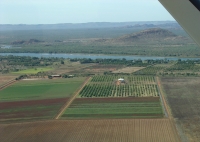
We had some excellent views of the Ord River irrigation area as we flew over Kununurra and the local reservoir. We landed at Kununurra to refuel. The coffee enthusiasts apparently managed their second good coffee there, having waited since Cable Beach. (Photo left: Ord River irrigation area; right: Kununurra Airport.)
On our way to Darwin we flew over Joseph Bonaparte Gulf. The ground seems so low and split by waterways meandering all over. Approaching Darwin we could see extensive port facilities. Some large warships were in port, including what seemed to be a helicopter carrier. (Photo below left: Joseph Bonaparte Gulf.)
There is a -90 minute time change entering the Northern Territory on our way to Darwin (-12 27S 130 50E).
We were scheduled to arrive at the Holiday Inn, 122 The Esplanade, Darwin, (08) 8981 5388, around 3 p.m, but didn’t land until slightly after that, a half hour late. Our guide Patrena met us with a bus. We went to the hotel, where we dropped off our bags and then were taken on a town tour.
We stopped at Woolworth’s first to get drinks for the following day (our destination was another BYO stop). Petrena suggested checking the spray paint artist from Sydney who does his (paper) works in Darwin through most of the dry season, and has done so for 6 years. They were great. If we thought they would have survived the trip, or if we had any place to put them Eric would have bought a few.
The tour of Darwin included Government House; Chief Resident’s (presently country singer Ted Egan) house; the old town hall ruins (formerly Palmerston Town Hall), destroyed in Cyclone Tracy on Christmas Eve 1974; Browns Mart, now converted to a community art theatre; State Square, which includes Parliament House and the Supreme Court; the modern metal and glass of Christ Church Cathedral; Barnett House, which survived Cyclone Tracy; the popular docks where several large US warships had arrived in the morning. The city was full of US marines on RandR. The club and restaurant street is directly behind our hotel. (Photo left: Darwin Town Hall ruins; right: Sunset at Fanny Bay.)
Sunset viewing over Fanny Bay, with champagne from David and strawberries (for the second time) from another tour guest. It was great. Dinner was a buffet served at the group’s table. The food was wonderful.
Page last updated 23 January 2007
