
Katherine, NT to Kununurra, WA (5 days)
Photo albums from the trip (more photos than shown on this page): Days 12–14, Days 14–15, Day 15, Days 15–16, Day 17.
These notes were written by Eric and occasionally amended by Jean. Eric took some of the photos and Jean took others. All photos were selected, cropped, and inserted into this file by Jean. Factual information was taken from various sources including tourist brochures; we do not guarantee its accuracy.
Click on a photo to see a full size version. Not recommended for readers on dialup connections—some of these files are between 1 and 2 MB.
Day 13, Katherine to Victoria River Crossing, Thursday 17 June 2004
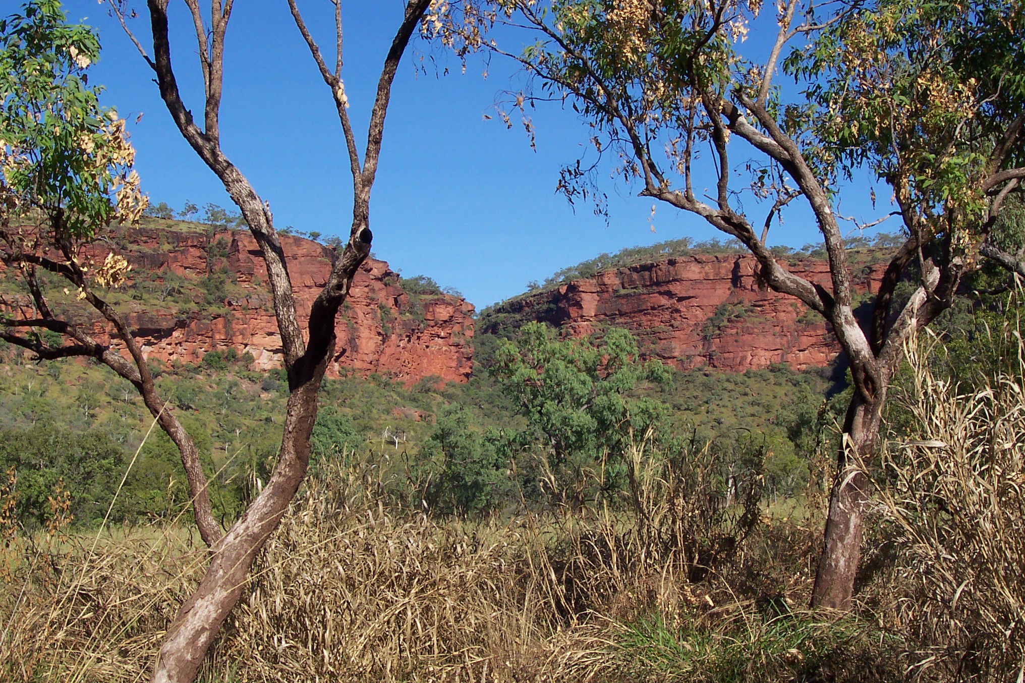
 We left fairly late, around 9 AM. Jean drove the 200 km along the Victoria Highway to Victoria River Crossing, in the eastern (Victoria River) section of Gregory National Park (13,000 sq km). We stopped pretty frequently to take landscape photos, however many of the better views were where pulling over was a problem. The landscape changed from flat to weathered hills and plateaus, all much greener and lush than we had expected. Some of the rivers still even had water in them.
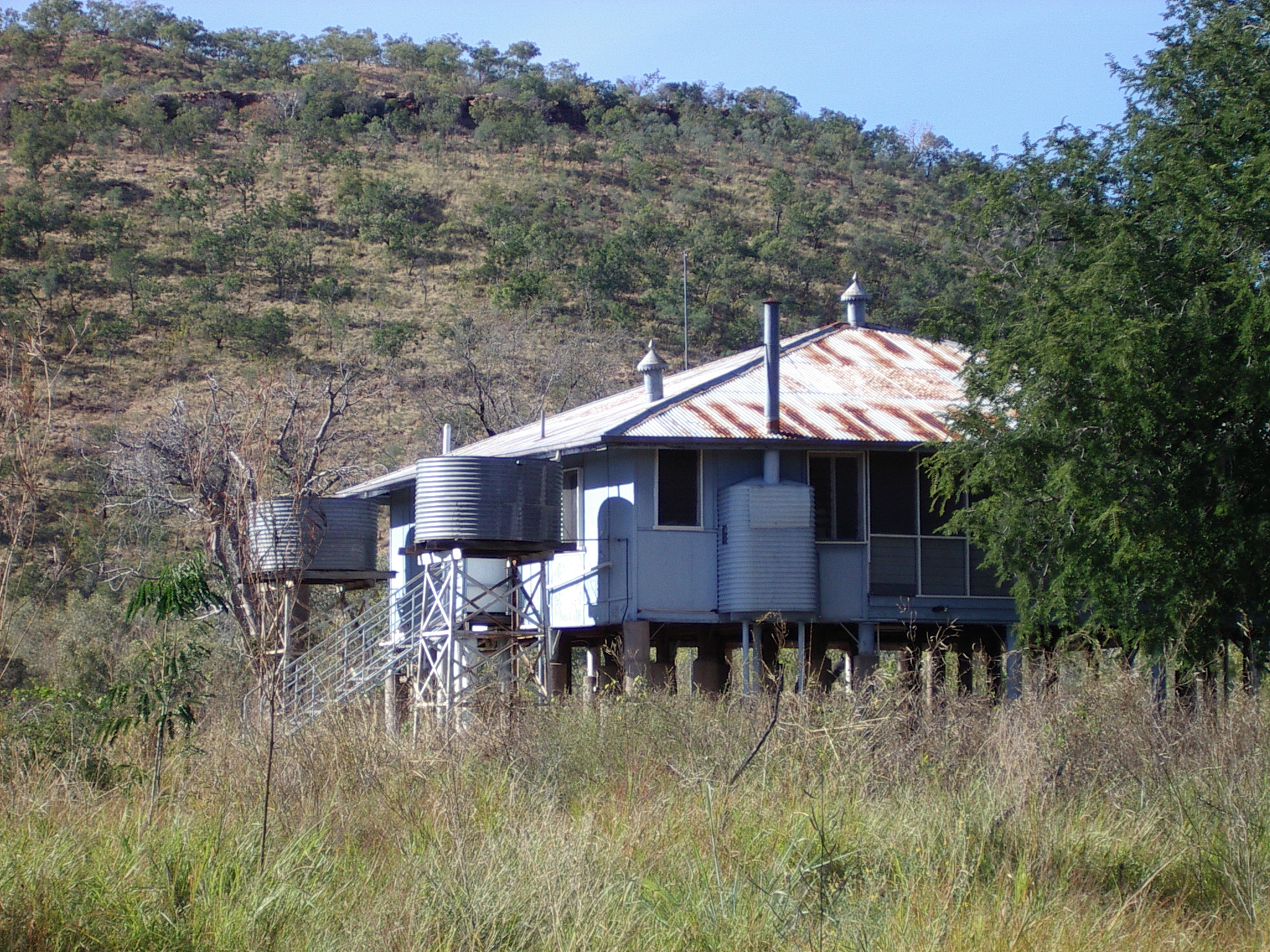
 We stoped early for the day, at the roadhouse at Victoria River Crossing (latitude 15.37S, longitude 131.08E, map ref. 15), now apparently under new management (well, it was new three years ago, but who needs to take signs down?) Had a nice chicken and salad sandwich lunch, and booked a room for the night. After a rest we went for a walk along an overgrown path down to the river. Obviously we didn’t go in the water, as saltwater crocodiles might like a meal. Victoria River is one of the longest rivers in the Northern Territory.
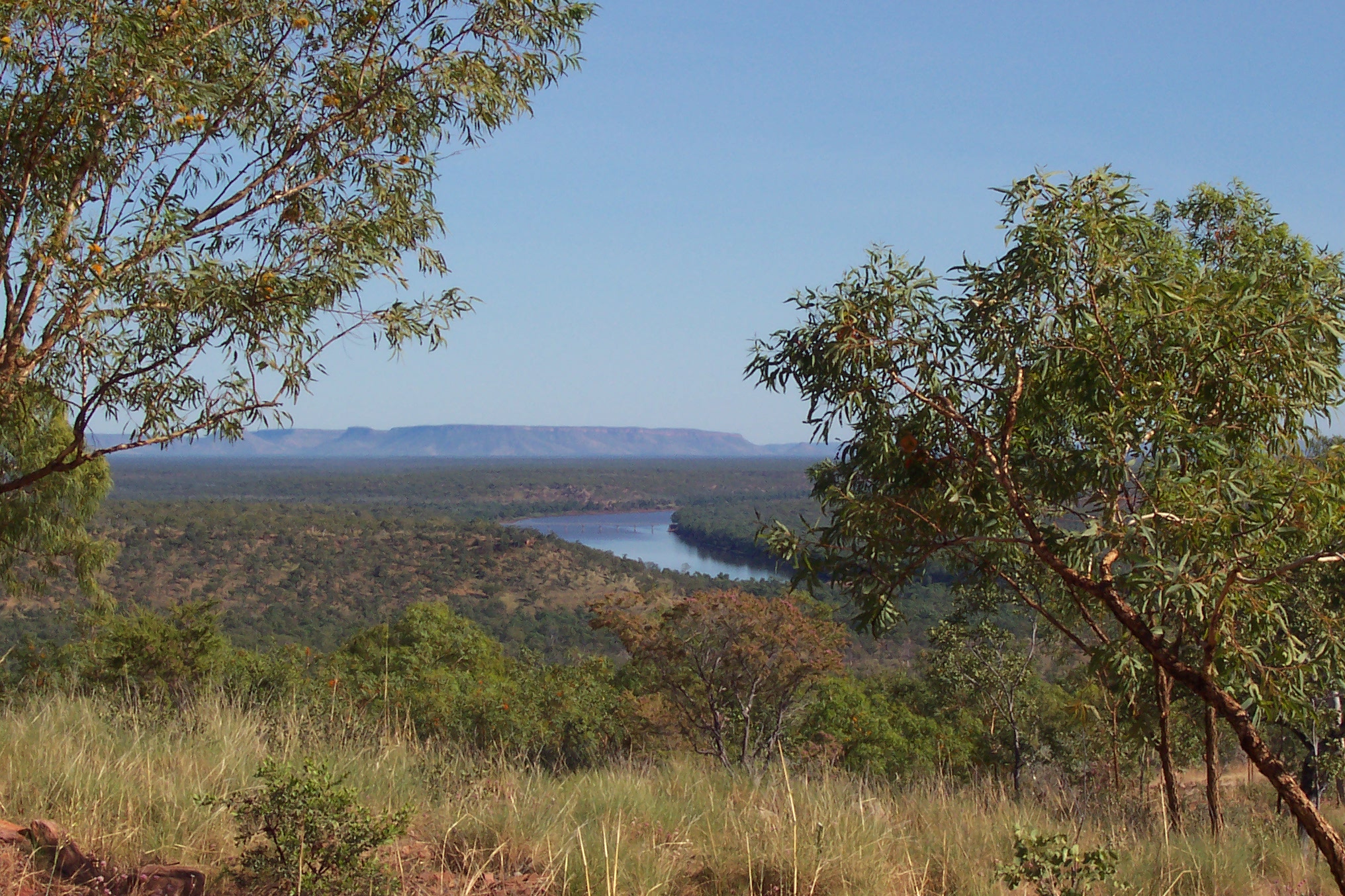
 Our next walk was down the highway to the bridge across the river, where the water was about 8 metres below the roadway. We noticed flood depth signs all the way back along the road to the roadhouse, where the flood depth sign showed the 26 metre level.
We hoped morning will bring better lighting on some of the surrounding cliff walls, and indeed it did.
Day 14, Victoria River Crossing to Timber Creek, Friday 18 June 2004
 We drove to the river to see where the boat tours leave from. The last of the track looked a bit too rough. We also located the Gregory National Park escarpment walk access point. Next we went down a rough trail to the old road crossing for a walk plus photos of the low level crossing where the river is very shallow. Our next stop along the Victoria Highway in the Gregory National Park area was the Joe Creek walk area, which gave a very different view of cliffs.
About 57 km down the road was Kuwang lookout, showing the Aboriginal names given to various parts of the distant escarpment.
 We reached Timber Creek (pop 300, latitude 15.40S, longitude 130.29E, map ref. 16), in time for lunch. This is a small township within the lands of the Ngaliwurru and Nangali people, after a 1984 land claim.
The major tourism things seem to be scenic flights and boat tours, crocodiles, plus ever present barramundi fishing. Some of the scenic flights seemed good value, with a very reasonable Bungle Bungles and Argyle Diamond Mine flight by Northern Air Charter at under $300.
Explorer Augustus Gregory named Timber Creek in 1855, when he stopped to repair his boat with local timber. The town was however just known as the Depot in early days, when it was a distribution point for supplies shipped in for remote cattle stations.
Day 15, Timber Creek to Kununurra, Saturday 19 June 2004
 We checked the Heritage Trail, where we were able to inspect the old police station from 1908, now a museum. From 1898, Constable O’Keffe was basically camped in a bough hut, so I’d imagine the permanent station was a great advance. A replacement police station was built on stilts in 1935, and both are preserved as historic buildings. Nearby were graves and a very enlightened comment about the wake.
 We continued 6 km west of town to the turnoff to various lookouts above the river, giving spectacular views of the countryside and the entire town. A monument celebrated the activities of the Nackeroos, the North Australian Observer Unit, a horseback force in the outback in WWII. The road in to the lookouts was much better than we expected, with most of the uphill sections fully paved under a Federal and local road scheme. One feature Eric found fascinating was the orange coloured trees in this area. We have no idea of the species, and have not seen them anywhere else.
Further along the main road we came to an impressive military bridge across the river. Although the road was closed, this led to a defence firing range on what was probably once Bradshaw station.
We diverted 16 km west of Timber Creek to view the Gregory Tree, a boab vandalised by carving in 1855-56 by Augustus Gregory, one of the better Australian explorers (he didn’t kill himself while exploring). This was a permanent camp for Gregory’s expedition, and is situated on the banks of the creek. Like most of the previous tourist sites, it is in Gregory National Park.
 Entry to the Keep River National Park (750 sq km) was to the north, just 3 km before the N.T. and W.A. border. Formed gravel roads with (alas) the usual corrugations make for reasonable dry season entry by conventional cars. The drive in was about 25 km of dirt road. There are picnic tables and pit toilets in the park. The park is in the tribal lands of the Mirriwung and Gadjerong people, and includes a Nganalam (cockatoo dreaming) tribal art site of around 2500 drawings, as well as secret sacred sites to which entry is not permitted. There are several Aboriginal communities within the park boundaries.
 We went for a walk in the Keep River gorge, and the late rain had left some pools of water in the gorge floor. You wouldn’t want to go swimming even in the river, due to crocodiles. The Keep River National Park features a 250 million year old Palaeozoic volcanic landscape, as well as limestone cliffs. Boabs trees dot the landscape and march up steep hillsides like lonely sentinels.
At the West Australian border we encountered plant quarantine. We had previously either used up or discarded all our fruit and vegetables, and discarded our remaining honey. We weren’t likely to have anything else of interest to the quarantine authorities.
It was interesting to note that just after the border we encountered gently rising country. Where we had previously had scenic plateau, now the landscape was seriously tilted and twisted, looking like a set of children’s bricks in collision.
 When further along the road, we diverted to Lake Argyle (map ref. 17) for a visit. The Ord River dam was an impressive 335 metres long, and 98 metres high. There was a wonderful picnic area below the dam, which was built as an impervious clay core, earth fill dam in 1972, rather than as the original concrete design. The construction cost was $22 million in 1972, and Ord irrigation area crop output is now $70 million a year. We took many photos of the dam, and the impressive Lake Argyle, which covers 1000 sq km. It is a bit of a pity so many interesting geological formations have disappeared under the waters of the largest constructed lake in the Southern hemisphere. Lake Argyle is so large that it is considered an inland sea, and is the eighth largest artificial lake in the world.
The small 30 megawatt hydroelectric power station at Lake Argyle now also supplies the Ord River irrigation area support town of Kununurra, which we were surprised to learn had a population of around 7,000 people. The population of Kununurra approximately doubles during the tourist and fruit-picking season. The same hydroelectric plant supplies the Argyle diamond mine, and also Wyndham, from its 220 gigawatt hour annual output. These sites all used diesel power plants until relatively recently, although the hydroelectric plant was installed when the dam was built.
It was about a 35 km drive back to the highway, and then another 35 km into Kununurra (pop 6000, latitude 15.46S, longitude 128.44E, map ref. 18). We soon located the Hotel Kununurra. We were somewhat shocked by the room prices (around twice what the RACQ accommodation guide suggested), but it was still almost the cheapest place in town for a room with phone access. Jean negotiated a bit of a discount with Sa, the very active receptionist, who also seemed to be organising part of the dinner area and the Zebra Rock bar. The name gave me pause. I hate rock music. However it turned out to have an entirely different meaning, to do with a local striped rock formation.
Day 16, Kununurra, Sunday 20 June 2004
 We took a long walk through lots of the business area. There were many signs that outback tourism was a major activity of the town.
We visited the extensive and helpful Kununurra Visitors Centre tourist information area in the Kimberley Tourism House building, and were able to get details of more areas to see.
In part of the same building was the local Telecentre network. This community owned and operated internet access area was originally state government funded around 11 years ago, with a $30,000 startup grant, and is one of nearly 100 in West Australia. Funding from the West Australian Department of Local Government and Regional Development is only given to communities that have sufficient enthusiasts who want to do this sort of work, and also have a plan of how they will maintain the facilities. The government department provides the network connection, however the community has to fund the computers and their replacements, and also provide the space to accommodate the centre. As each Telecentre is autonomous, the facilities and rules vary considerably in each community. For example, this one had space for you to use your own laptop with a network connection. It also had a service to burn digital photos to a CD. Whatever the services available, all Telecentres co-operate in solving problems faced in common, by use of internal forums.
We were much more impressed by the attitude of the Telecentre co-ordinator here in Kununurra than we were by the internet access at the Rural Transaction Centre in Mataranka in the Northern Territory. There they were afraid of computers, and couldn’t imagine allowing travellers to connect to the network. This made the Mataranka system of little use except perhaps for looking at web pages.
 Kununurra being a major town, it had a newsagent, and the newsagent was open. However newspapers arrive midmorning the day after their cover date. This is distinctly better than no newspaper at all, so we were able to get the Weekend Australian.
 We drove around the extensive flat Ord River irrigation area surrounding the town, set up in the 1970s. Kununurra (a local Aboriginal term said to mean “meeting of big waters”) is the service town set up in 1958 and gazetted in 1961 for the area before the irrigation area was established. It is thus one of the newest towns in West Australia, and is fairly large, with a population of around 7,000.
We went out Ivanhoe Road, then diverted a short distance along River Farm Road to Barra Barra (a place to buy fresh local produce and enjoy mango smoothies and other snacks) and Top Rockz (an art gallery featuring items made from the local Zebra Rock and other rocks and minerals. Then back to Ivanhoe Road past many crops, including mango trees and sugar cane (all very reminiscent of home), to Ivanhoe Crossing, where the water flows freely over the causeway. Apparently the water flow was a bit heavy, because the crossing was closed to traffic. Presumbly it’s open to 4WD later in the Dry season.

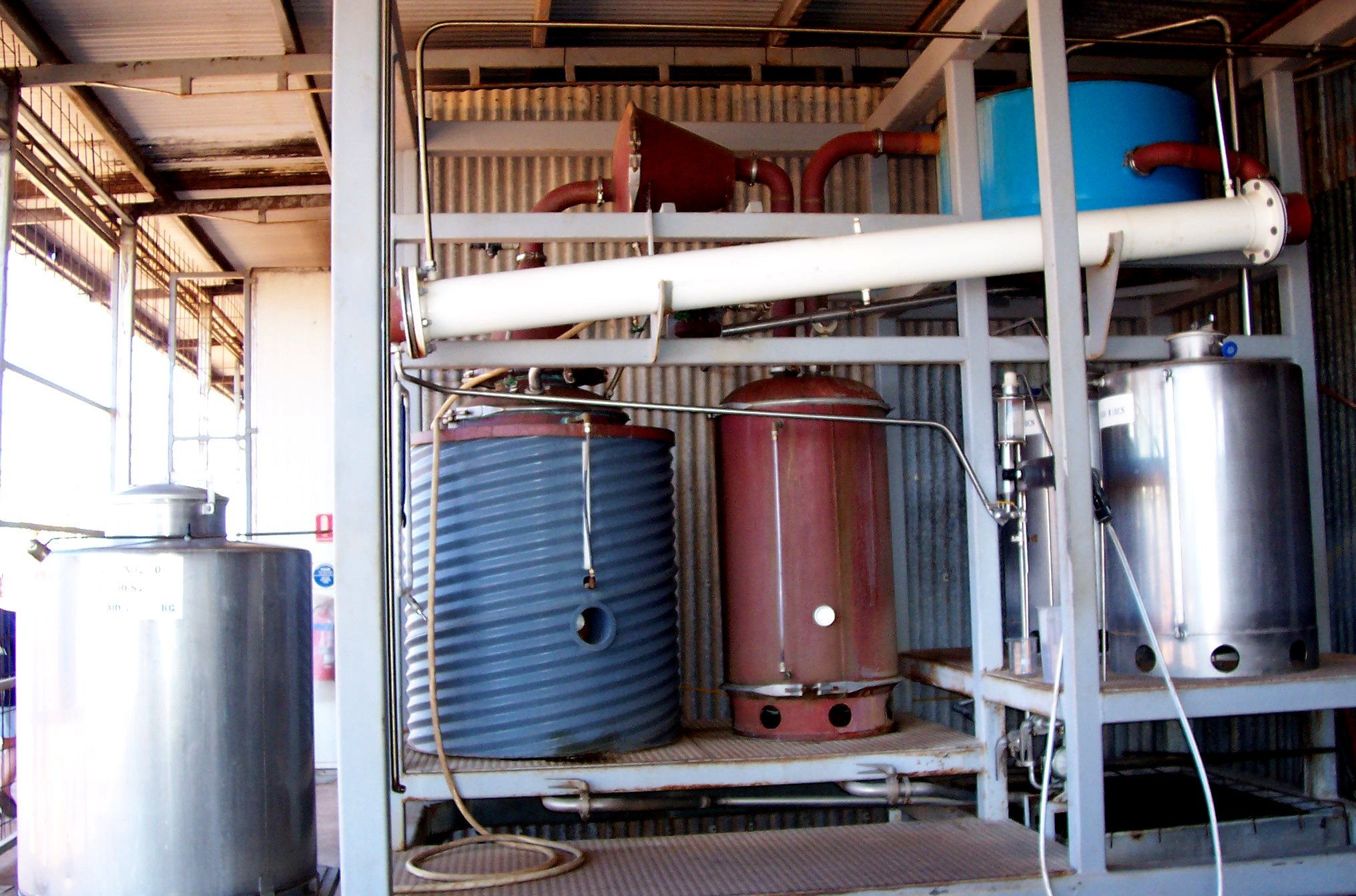 We visited The Hoochery rum distillery on Weaber Plains Road. This is the only legal pot still rum distillery in W.A. They make their rum from Ord River sugar cane molasses, using wet season rainwater. This isn’t a large operation. The labels were even originally hand signed (they said they found 1000 labels a week a bit of a chore, and now use a rubber stamp). After sampling their two year oak barrel matured rum and the less mature cane spirit, we bought a bottle of their Ord River Rum to use with mixers, and then didn’t mix it. This is the finest Australian sipping rum we have ever tasted! Not as flavourful and forceful as the somewhat harsh Bundaberg, but with lots more flavour than the too genteel Beenleigh.
Back to town past the small sugar mill (we estimate a half million tons a season) and on out past Diversion Dam and Packsaddle Road to Zebra Rock gallery. This was a wonderful place for rockhounds. The soft 600 million year old striped zebra rock is unique to small reefs of stratified shale in a pastoral area near Kununurra. The stone is a fine grained siliceous argillite siltstone, in which the red bands or spots are coloured by ferric oxide. We bought a bag of samples, to turn into paperweights (about the only extra item we can allow into our apartment). The open air workshop lets you see exactly how the stone is worked.
Day 17, Kununurra, Monday 21 June 2004

 Jean left at 8:30 for a light plane flight to view Mitchell Falls and the Mitchell Plateau. Her tour was with Kerry and Pat Slingby’s Slingair, one of the most successful W.A. air tour operators, a family company now running 50 aircraft from their base at Kununurra airport. She was one of 4 passengers on the tour.
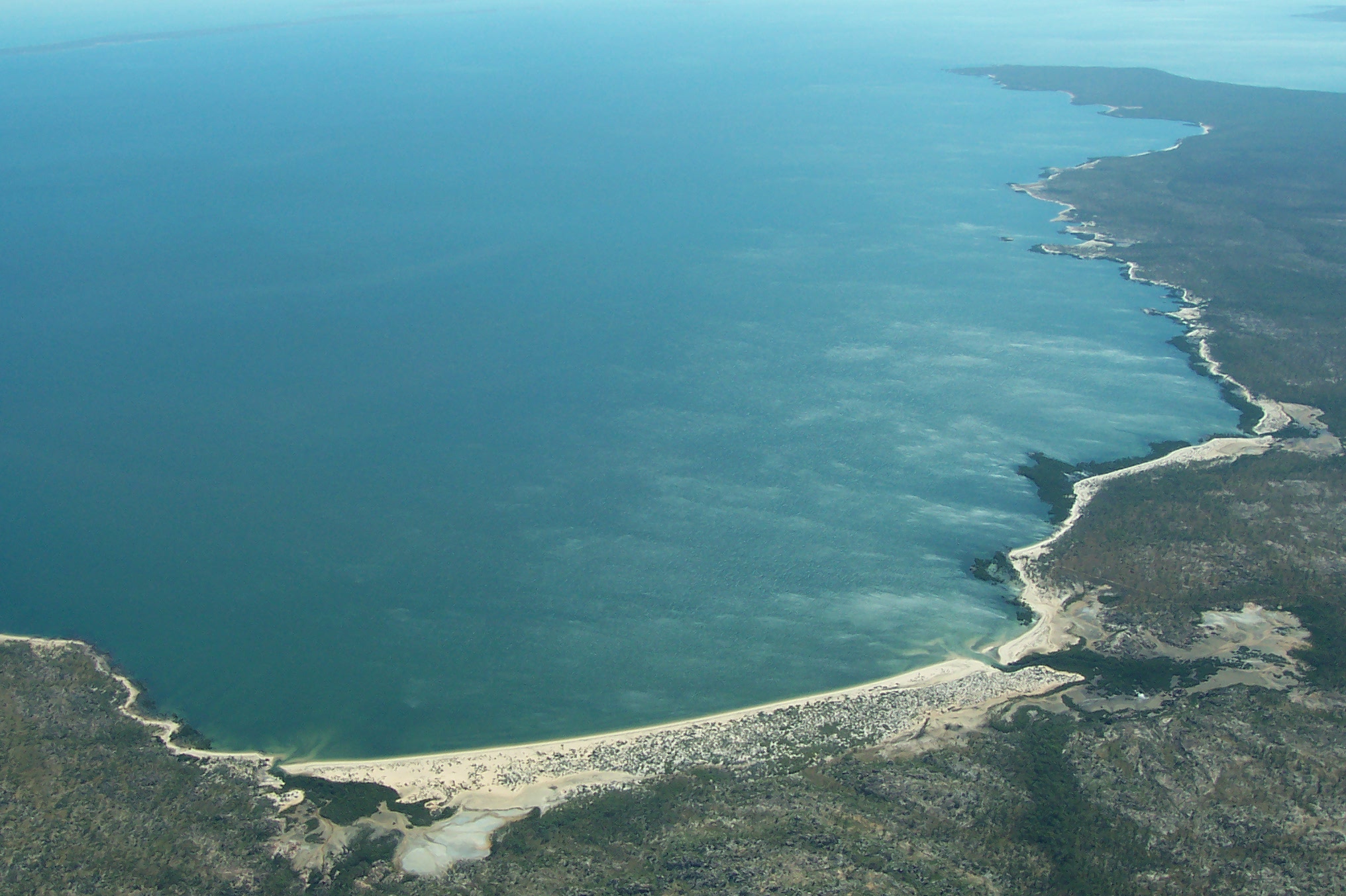
The flight went northwest over part of the Ord River irrigation area, then tracked north and west along the East Kimberley coast (Cambridge Gulf), passing over various rivers, ranges, gorges and waterfalls, most of which were on the wrong side of the plane for good photography. Still, the view was spectacular and showed the diversity of the landscape. King George Falls is on a gorge that can be reached by coastal boats (two of which are in the photo to the right).
We passed over The Bush Camp at Faraway Bay, one of the most exclusive and expensive resorts in the Kimberley, which takes a maximum of 12 guests; Kalumburu, an Aboriginal community, orginally a Catholic Mission, which hosted an American airbase during WWII and was bombed by Japanese aircraft; and Kimberley Coast Camp, another exclusive resort.

 The photos to the right and left are of the Kimberley coastline. At least two exclusive and expensive tour boats operate along the coast between Darwin and Broome. (More details to be filled in when we find the brochures.)
The plane landed at the Mitchell Plateau for a snack and a much-needed toilet break, then resumed with a flight over the Mitchell Falls (photo below left), then south through the central Kimberley to Drysdale Station for lunch. The central plateau is very different from the coast, as one might expect.
 On the way back to Kununurra we crossed the Gibb River Road, several rivers (some with conspicuous gorges), the El Questro resort, Emma Gorge, and a lot of rugged-looking countryside. (Photo left: Mitchell Falls.)
Eric still had a cold, and stayed behind to do our laundry. He took some photos around town, looked at Argyle diamonds, did some shopping, dumped surplus books we had read in the free book bin at the Telecentre, and visited a number of Aboriginal art outlets, including Red Rock Gallery in Coolibah Drive.