
Exmouth to Perth (10 days)
These notes were written by Eric and occasionally amended by Jean. Eric took some of the photos and Jean took others. All photos were selected, cropped, and inserted into this file by Jean. Factual information was taken from various sources including tourist brochures; we do not guarantee its accuracy.
Click on a photo to see a full size version. Not recommended for readers on dialup connections — some of these files are between 1 and 2 MB.
Photo albums from this part of the trip (more photos than shown on this page) are here: Days 49-50, Days 50-52, Days 53-54, Day 55.
Day 49, Exmouth to Carnarvon, Friday 23 July 2004
We got away well before 8AM in light rain, however as we left, the caravan park warned us that the road south had been cut by floodwaters both before and after Carnarvon. We decided to continue since road conditions change rapidly. The rain wasn’t helping our mood any.
We made a stop at the solar observatory about 40 km down the road, however it had a number of large unfriendly signs around it, so we gather it didn’t encourage tourists.
We also stopped to look at the commercial airport at Learmonth, which is the main air access to Exmouth and that area. It has a modern, trendy appearing terminal done in bright colours, with the sort of shapes you get from modern lightweight metals. The inside looked much like the small terminal back home at Proserpine. It seemed very deserted, and like Proserpine probably has only a few flights a day.
We diverted after about 160 km to visit the small coastal town of Coral Bay (pop 220). This looked very sand blown and waterlogged when we arrived. Coral Bay gives access to the southern end of Ningaloo Reef, and seemed full of diving and snorkelling tour operators. Very like Airlie Beach of say a few decades ago. It will be interesting to see how it develops over the years.
We found another road advisory notice from 9:30 a.m., saying that there was flooding but the roads were all open. Jean was able to get a phone connection on her CDMA mobile here, and the road information she picked up confirmed the notice we had seen.
We crossed the Tropic of Capricorn 8418 kilometres into our trip, at 10:45 AM.
 Back on the road south, and we had a bit of water over the road at the Lyndon River causeway. We watched someone else ford it, and as the Subaru has 200 mm ground clearance, we had no problems.
 We rejoined the main north south road, the North West Coastal Highway, shortly before Manilya roadhouse. There was another water crossing just before the roadhouse, which also looked pretty waterlogged. We collected some sandwiches for lunch at Manilya just after 11 a.m.
We had left Manilya some time after a convoy of vehicles. About 20 minutes down the road we came upon about a half dozen stopped vehicles on a straight stretch of road. It seemed that one of the 4WD had rolled over, and ended up some distance from the road, probably only shortly before. It wasn’t within phone range of anything, and there were plenty of people to lend assistance, so we continued on our way.
We came to a turnoff to the coast when within a hundred kilometres of Carnarvon. Dampier Salt have yet another facility 50 or so kilometres outside Carnarvon on the 2072 square kilometre Lake MacLeod, which was between the coast and the highway. We didn’t even attempt to cross to the coast to see it, or the blowholes, or the HMAS Sydney memorial. Way too much water likely on that minor road.
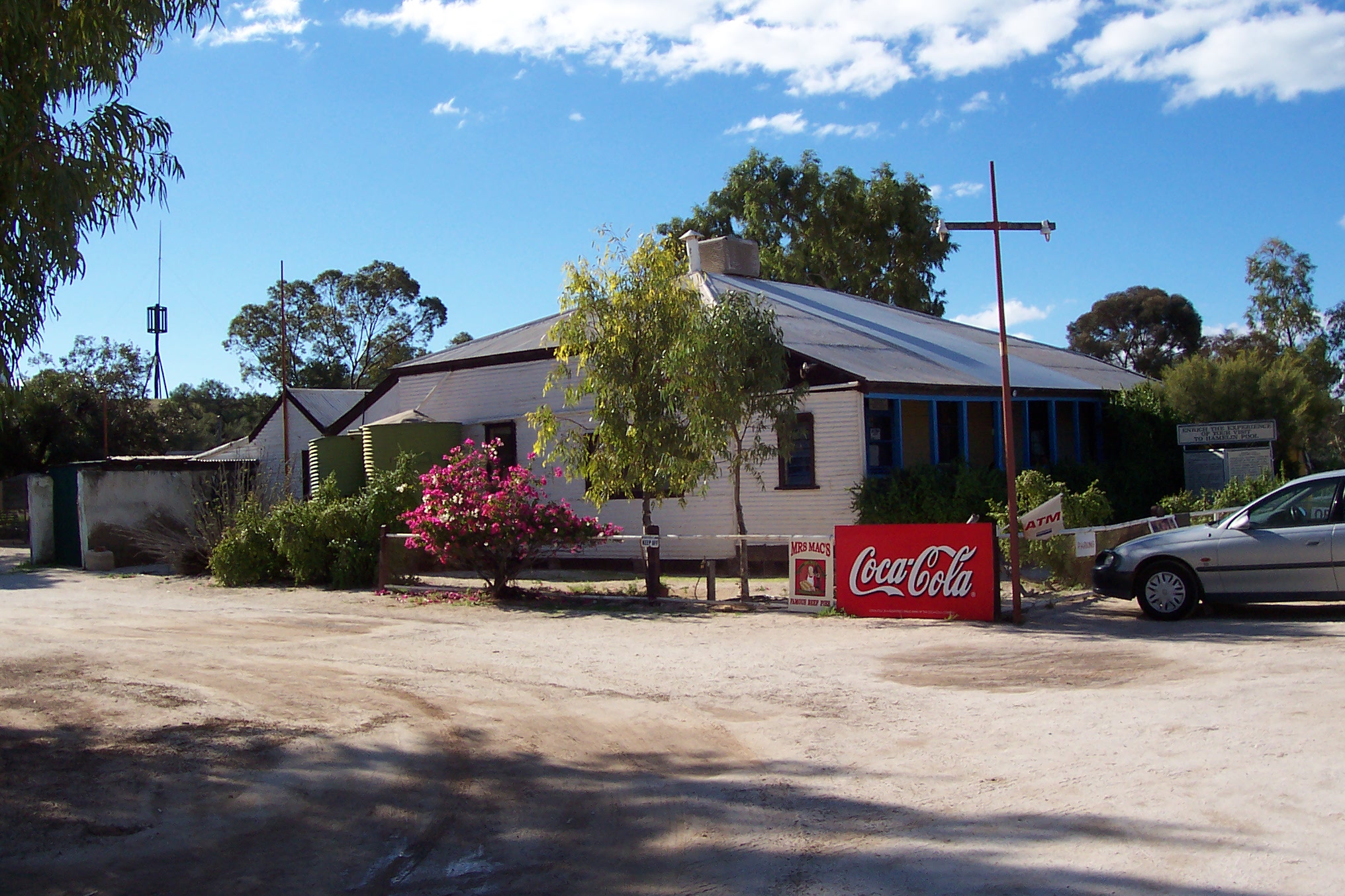
We stopped at a bitumen parking area about 20 kilometres from Carnarvon to find the closest thing we had to an Carnarvon map. Another motorist (and his large friendly dog) wandered over and started chatting with us. He was an itinerant artist driving an autogas (LPG) fuelled car. Neither of us have ever had anything to do with autogas engines, so we couldn’t help him with his starting problem. He had been stranded there for several days, hoping that the weather would warm up and perhaps help cure whatever was wrong with the car. We still weren’t within mobile phone range, so we couldn’t even help him with a phone call home. He obviously didn’t like the cold weather (neither did we). We suggested he ask motor home owners when they stopped, as many seem to be good mechanics. He wandered off to the motor home parked behind us to do just that.
 The town of Carnarvon (pop 6500, latitude S24.54, longitude E113.39), by the Gascoyne River, was named after Lord Carnarvon, British Secretary of State for the Colonies in 1876 when the town was settled for the pastoral industry.
The large satellite tracking disk on the outskirts of Carnarvon was installed by OTC in 1966, and received the first satellite TV transmission to Australia. It was also used during the moon flights, and in tracking Haley’s Comet. It was closed after that in 1987. It is now an unattended tourist site, but even in the rain was a spectacular sight.
Thanks to Jean being efficient several days ago, we were booked into the Best Western Hospitality Inn. Jean’s navigation was perfect, and we were soon in the room, and unloading stuff in the light rain. We have internet access here! Alas, like every other place since we left the Queensland coast, it was slow.
Day 50, Carnarvon to Denham, Saturday 24 July 2004
Good weather at last, with a clear sunny day, and no sign of rain.
 We stopped at the local shopping centre to collect a ten litre container of water. Drinking water is in short supply on the 400 kilometre trip to Geraldton, and we are making many side trips.
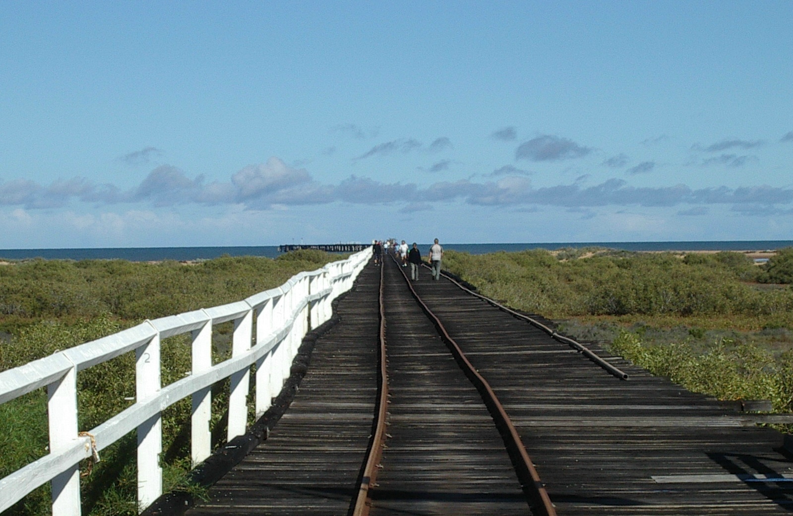 The 1897 one mile jetty at Carnarvon was the first in the world to load live stock on ships, with an animal race the length of the jetty. Ship trade ceased in 1966 and road trains took stock instead. The jetty was heritage listed in 1998 and is now being preserved. You can walk to the end of it, and fish from it.
The local historical museum is looking after the jetty. There is also a reasonable railway museum at the start of the jetty. The nearby lighthouse keepers cottage is a fine example of early 20th century building. The small lighthouse is also still there.
We revisited the giant OTC satellite dish to get some photographs while it wasn’t raining. It looks even more impressive in fine weather. We also had a much better view of Carnarvon.

 We soon ran into more water hazards on the road not long after leaving Carnarvon, however regular traffic was getting through. None of the water running over the road was deeper than 300 mm, and most was under 200 mm. The surrounding countryside was mostly pretty flat, and there was a lot of standing water, and even more mud to be seen. Many dirt side roads were obviously closed to traffic.
We stopped at Wooramel roadhouse for lunch, that being the first roadhouse (or anything else) we reached. It looked pretty damp, with lots of mud and lots of puddles. Got our usual chicken and salad sandwiches. We also noticed pastries and cakes, all home made by the man of the roadhouse. The apple turnover we had was pretty good.
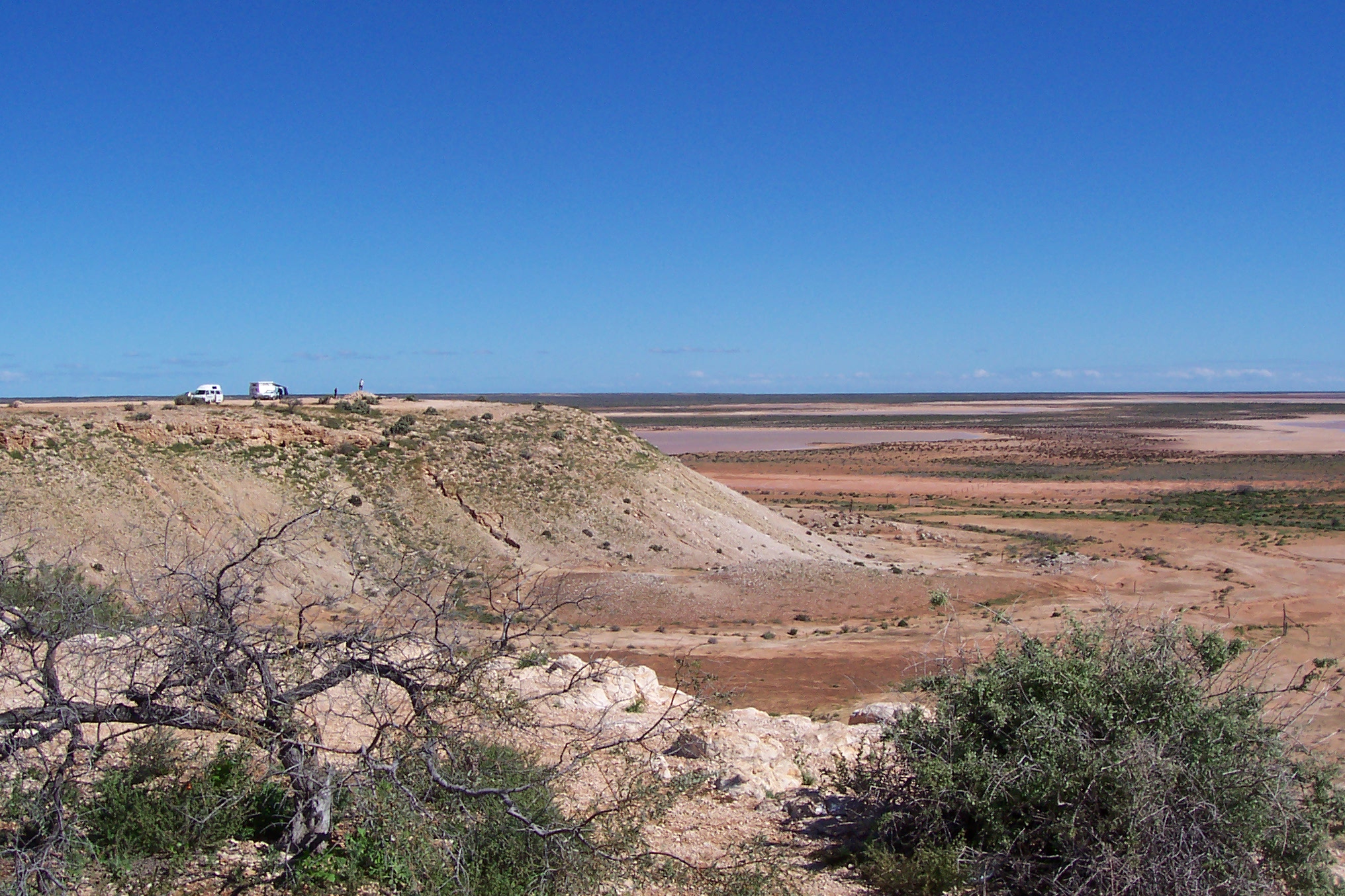
 Not far from Wooramel we came upon a fine lookout which gave extensive views over the flat countryside. You could see the red mud extending it seemed as far as the horizon. We took a bunch of photographs, since you don’t often get a chance to see the areas flooded (the roads are usually cut when it happens).
We continued along the North West Coastal Highway until we came to the turnoff to the Shark Bay World Heritage area. We were surprised to note that the tourist radio channel (FM88) was available in that area. It seemed to be coming from antennas at the Overlander roadhouse at the junction, which is about the only thing around for a hundred kilometres. The roadhouse looked very busy, and very waterlogged and muddy. It actually provides a telecommunications link to the rest of Australia, because the Telstra optical cable goes along the South West Coastal Highway and has a link at this isolated spot.
 About 20 kilometres down the Shark Bay road we reached the turnoff we wanted. This led to the old corrugated iron and wood Hamelin Pool telegraph station, built in 1884 near the shore of what was then known as Flint Cliff (named after a small but prominent white cliff a few kilometres further along the coast). This is one of the few surviving post office relics from the 38 telegraph cable stations from Wyndham down the West Australian coast to Albany in the south. They had a small museum of telegraph relics, plus more outside. There was a flagpole on a small hill by the shore, so coastal supply steamers could locate the isolated outpost.
Solar panels on a small tower by the seaside power a radio link to an automatic telephone exchange at the Overlander roadhouse back on the main road south. This is how the phone connection is made from this spot.
As we were walking down to the beach we head a most distinctive and melodic songbird, which Eric photographed at some considerable distance.

 Some of the old walls were made of shell blocks or coquina, cut from a quarry by the seaside. The quarry is still used to make repairs to existing shell blocks. You can see the steps cut out and the saw marks. The whole beach area, for many kilometres, is made of tiny Cardiid Cockle shells (smaller than a half centimetre wide) cemented together by their own dissolved calcium carbonate material. Some station homesteads and St Andrews church and the Old Pearler restaurant in Denham are made from this material, as early settlers had little building material.

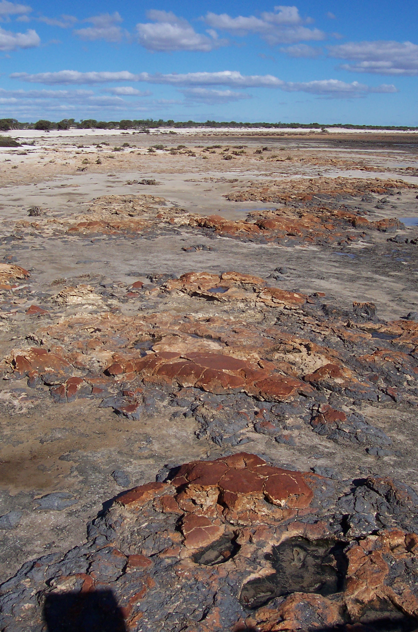 After a short walk we reached a boardwalk out over the sea. Stromatolites were the attraction here, although they are not exactly a lively item, being basically a layered limestone rock. Single celled cyanobacteria (blue green bacteria) produced these structures, some as bumpy towers, others as flat spongy mats. These living fossils from two or three billion years ago were what originally extracted carbon dioxide from the atmosphere and produced the oxygen that land animals needed to thrive. They were once believed to be extinct. They survive here partly thanks to a high concentration of salt in the shallow and partly isolated sea.
From Saturday to Monday we are booked into Denham Seaside Tourist Village (latitude S25.55, longitude E113.32), at Shark Bay, within reach of such attractions as Monkey Mia dolphins, and Francois Peron National Park. This is claimed to be the most westerly caravan park in Australia, and by my figures, it would be.

 We took a walk through the town once we had unpacked. The wind was making it cold, and as the sun set, it got even colder. We really know that we are out of the tropics now. Having identified the local cafes and restaurants, we checked their menus, and most looked very acceptable. However, we picked up ingredients for making pasta, as the cabin at the tourist village has complete cooking facilities. Jean thought it a shame not to make use of them.
Shark Bay was called Catharruguda, meaning two bays, by local aborigines. The Dutch captain Dirk Hartog landed at Cape Inscription on Dirk Hartog Island on 25 October 1616 and nailed an inscribed pewter plate to a post. You can see Dirk Hartog Island, the largest in W.A., across the water from Denham. Willem de Vlamingh replaced the plate with one of his own 81 years later. Dirk Hartog’s plate is now in Rijkes Museum in Holland, while Vlamingh’s plate is in the Maritime Museum of WA in Freemantle.

 William Dampier named the area Sharks Bay in August 1699. The surveyor Ommanney arrived in the Monkey in 1834, to evaluate the area for a settlement. Monkey Mia was named for the vessel, and the aborigine name for rest or home. Shark Bay was charted in 1858 by Captain H H Denham, from whom the town takes its name. Denham was a pearling centre until shallow waters were worked out towards the end of the 19th century. It now supports fishing, pearling, salt manufacture and tourism.
Francios Peron National Park was named after the French zoologist who visited in 1801 on the Geographe under Captain Baudin. Captain Hamelin was in charge of the Naturaliste. This National Park covers 52,500 hectares on the northern tip of Peron peninsula, and was once a sheep station.
The Shark Bay marine park covers 1500 kilometres of coastline, the largest in Australia, and occupies 748,735 hectares.
Day 51, Denham, Sunday 25 July 2004
 There were three nice looking wind turbines just outside Denham, on slim and elegant single towers. These were at least three times the size of the experimental ones we saw at Exmouth. These ones produce about 230 kW, and the three provide about 20% of the power for Denham. They save around 175,000 litres of diesel fuel a year. They are designed to withstand 200 kph cyclone winds, but they stop producing power when winds exceed 90 kph. You don’t really see a lot of wind farms, as they are not economically competitive with coal power stations, except at isolated areas where bulk fuel has to be transported long distances.
We took the bitumen road to Monkey Mia reserve, only 30 km or so from Denham. This leads past some wonderful coastal scenery, and some brilliant coloured water views.
There is a nice visitor centre at Monkey Mia, with explanations of interaction with the dolphins, displays and videos. They have various specimens from dead sea life on display. There is a small jetty where you get good views of the area, and of the dolphin feeding.
We couldn’t help notice a bird swimming and diving in the water around the jetty, chasing food. It was an exceedingly good diver and would stay underwater for considerable distances.
 Jean risked the cold water and got some close up photos of dolphins. The feeding is only in the mornings, and happens two or three times. While we were there, dolphins appeared inshore and also around the jetty well before feeding time.
 The four dolphins around the jetty seemed to be doing a lot of playing. They were however hard to photograph with a slow reacting digital camera due to their speed.
A pelican kept getting into the act. This creature got into the way of many photographs. It was eventually lured up the beach away from the dolphins when it was time to feed them. The pelican tends to snatch food intended for the dolphins, and I gather the dolphins were a bit annoyed about this.
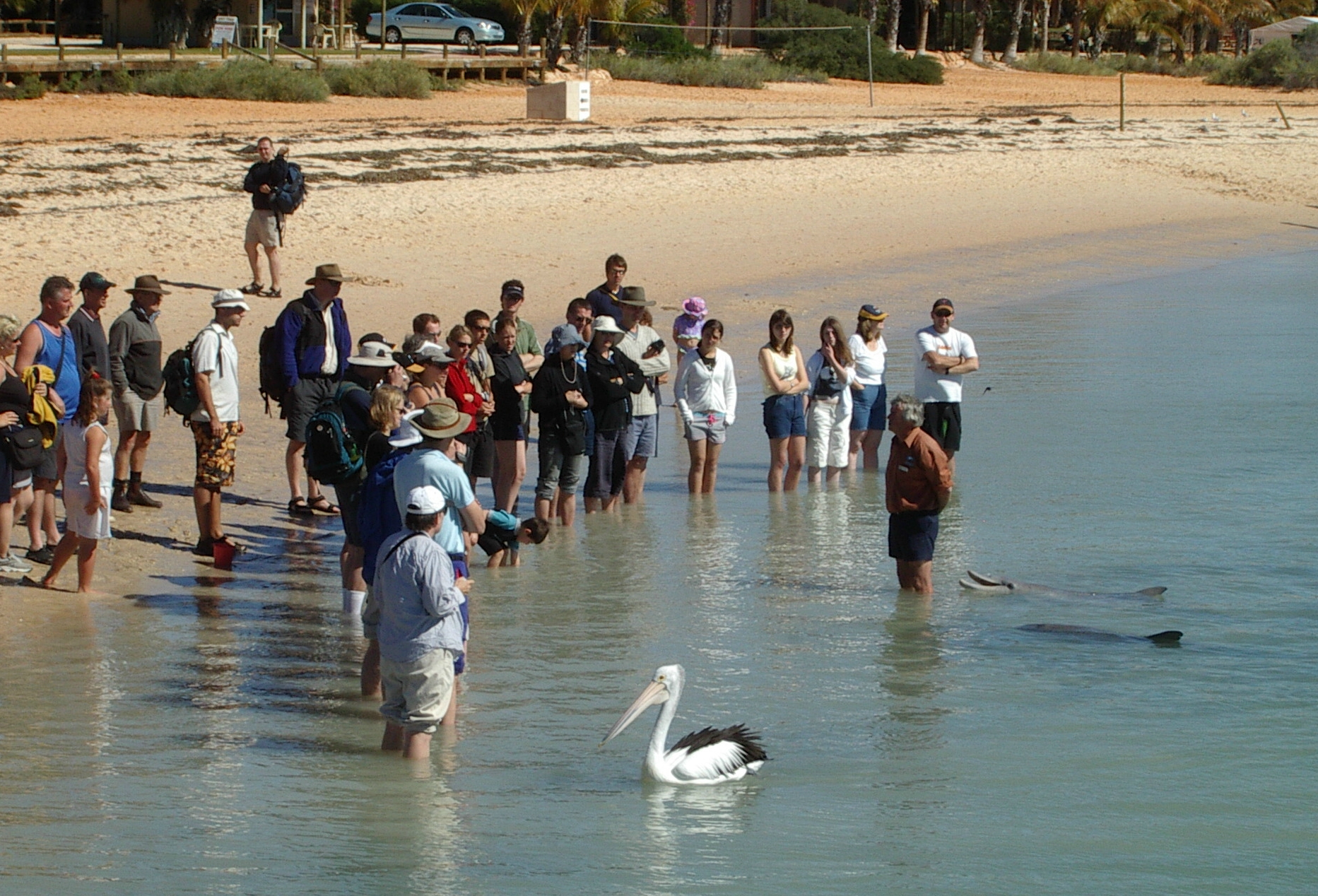 I noticed a seagull was also using the same tactics. The dolphins were herding fish into the shallows, and one seagull would keep swooping just in front of them.
Jean got to hear the ranger from Calm (department of Conservation and Land Management) talk about what they and various scientists were learning about wild dolphins.
 There is also the small Monkey Mia Dolphin Resort along the beach, right next to the dolphin interaction area. It had a convenience store and tourist material. I fell off the wagon and bought a Magnum Chocolate Addiction ice cream for my lunch. Jean resisted and waited until we were back in Denham to have some more pasta.
We went to the Heritage Hotel in Denham since they had a Sunday roast dinner. That went down very well, after all the days of steak sandwiches and similar. We think the last time we had a meal at a restaurant (as distinct from a cafe) was back at Kununurra.
Day 52, Denham, Monday 26 July 2004
Rest day. No driving, but we did take three walks along the beach, and along the seaside.
No newspapers at the newsagent. They don’t get the national paper during the week.
We went to St Andrews church, built from shell blocks which were a different colour to those we had seen elsewhere. The columns at the front of one of the pubs were also shell blocks, as also was the Old Pearler restaurant.
The Jetty cafe supplied a good lunch and great fish dinner. Pity we hadn’t found that first.
Day 53, Denham to Kalbarri, Tuesday 27 July 2004
Afetr we refuelled the car and as we left town, we took photos of Denham from a lookout on a side road some kilometers away near the coast.
Joined North West Coastal Highway after an hour and a half or so of driving.
Took photos of Overlander roadhouse, still suffering from the effects of several days of rain when we reached it after 10.
Then on to Billabong roadhouse for an early lunch. This is the only other roadhouse on this entire stretch of road.
We finally started to see real trees again rather than low shrubs of the desert areas. This means real rainfall occurs.

 At the exceedingly extensive Galena Bridge rest area we stopped to photograph wildflowers. I wondered about this name, as I recalled as a child making crystal sets using a galena crystal (and very unreliable they were). The name doubtless came from the former Geraldine Mine nearby, which was the first lead mine in Australia. We got away from the area around 1 p.m.
Cultivated fields abounded in this area, as we were obviously in a large river valley. We noted fields of canola.
We turned off North West Coastal Highway and headed for Kalbarri.
After about 20 kilometres there were new all weather roads into Kalbarri National Park (186,000 hectare) to river gorges cut into the limestone by the Murchison River. Kalbarri is famous for over 1000 varieties of wildflower.
Only four kilometres from the road road to town, Hawks Head had wheelchair access from the car park. The new viewing platform was only a 100 metre walk.

 Ross Graham lookout is along a short but rocky walking track from a car park only 1.5 kilometres from the road to Kalbarri. There is also a walk that continues down to the river, and this is the easiest path to the river.
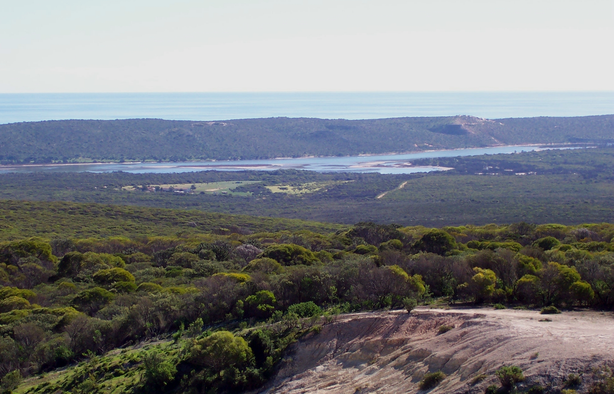
We came upon Meanarra Hill lookout outside Kalbarri around 3 p.m., at the end of a winding dirt road that was in very good condition. This gave excellent views of the town and the Murchison River mouth.
Kalbarri (latitude S27.43, longitude E114.10) is a fishing village turned tourist resort, near the sandstone gorges of the Murchison River and Kalbarri National Park. It is a very pretty and pleasant location, with a lot of work done on the foreshore park. The buildings are all low giving good sea views from shops along the seaside. Off the protected Murchison River mouth, the waves from the Indian Ocean crashed to shore, providing plenty of potential action for surfboard riders.
 We are booked into the Best Western Kalbarri Palm Resort, a few minutes walk from the shopping centre and not much further to the beach. Unfortunately, Tuesday was the day their restaurant was closed, so we had to find a cafe or restaurant in town in any case for dinner. Jean had been seeking a steak dinner for the past day.
After our experience in Denham, where the newsagent didn’t get the national newspaper during the week, we were pleased to see that newspapers had arrived in town, and on the same day as their publication.
We soon found a bakery, where Jean got an apple slice and Eric got a chocolate mud cake. Fresh from the baker’s hands, and very nice.
When we went back that evening Jean finally got her steak and Eric had chicken at a cafe. Both pretty giant meals. We had checked one of the pubs for a meal, but the noise level of the band practice there drove us out within seconds. Partly as a result of the large meals, we both pretty much collapsed for a while when we returned to our room.
Day 54, Kalbarri to Geraldton, Wednesday 28 July 2004
After a relaxed start, we headed back out the Kalbarri Road 10 kilometres, and then 26 kilometres of dirt road in the Kalbarri National Park. Luckily the dirt road had just been graded, and so was in really excellent condition with virtually no corrugations.
 At the T intersection we drove another five kilometres to views of The Loop walking trail and the gorges which contain it, and Natures Window. This is about a one kilometre return walk, with some scrambling over rocks, but generally fairly accessible.
 Natures Window is a small wind carved hole in the sandstone, through which you can view the Murchison River.
Back on the dirt road, we took the other arm of the road, and drove four kilometres to views of Z Bend, where the gorge plunges 150 metres to the river. Again, this is a one kilometre return walk from the carpark. We had some additional clouds by then, so viewing wasn’t always as bright as we had hoped for photography.
The walking trail led past numerous wildflowers, including bush orchids, so we stopped often to photograph these.
It was lunchtime by the time this was all done, so it was back to Kalbarri town for us.
 We bought lunch at the bakery when we finally got back to Kalbarri, and added
some apple slices (plus a mud cake for Jean) to our food supplies. By then it was around 1 p.m. and we still had a fair number of gorges to cover as we finally headed south.
The Kalbarri National Park coastal gorges are all along the road south that we needed to take to get to Geraldton.
It was here that the first white settlement of West Australia took place, when two mutineers from the Batavia were marooned for their part in the mutiny.
 We stopped first just down the road at Jacques Point to watch people surfing, despite the rocks that seemed ready to crush them on entering or leaving the water. Also had good views back to town.
 Red Bluff was named by Wilhelm de Vlamingh in 1697. The lookout at the car park lets you see some of the cliffs that extend 13 km south to the boundary of the National Park. You can also see back to Kalbarri.
Pot Alley Gorge gives another series of excellent views to the south. You can walk down to the secluded beach at the bottom.
Island Rock stands alone in the sea, an isolated section of cliff carved away from the mainland by the waves.
 Natural Bridge is similar to Island Rock, however here a rock bridge connects the outcrop to the mainland, and the sea surges through a hole at the bottom between the two.
Some people at the lookouts said they had seen two small whales, however we were not lucky enough to spot them.
Shellhouse and Grandstand show more of the spectacular cliffs of this area. Little wonder so much of the West Australian coast is associated with early shipwrecks. Mariners coming upon these cliffs under sail must have wished themselves well away.
 There were more varieties of wildflower at these lookouts, so we took more photographs. There are said to be over 800 West Australian wildflower species in this National Park.
On our way again, we eventually reached Geraldton (pop 20,000, 21153 kilometres, latitude S28.47, longitude E114.37) is 424 kilometres north of Perth, on the Batavia coast, with the 122 Abrolhos islands about 60 kilometres off the coast. Ships wrecked near it include the Batavia and the em>Zuytdorp.
Upon entry to the Geraldton area, at 21146 km, we encountered our first traffic light since Katherine. We subsequently encountered a considerable number of them in Geraldton.
We were booked into the Best Western Hospitality Inn, where we even had a continental breakfast included in the room rate. We had a hard time locating the motel, as road construction had closed the roundabout that identified where to turn. We went around the block, and eventually reached it from entirely the wrong direction. Once we located our Geraldton map, all became much less unclear. We did have to enter traffic again, since it was a little too far to walk (at least for Jean) into the town centre. We found an Eagle Boys pizza place, and for a mere $6.95 brought a large pizza home (along with a nice bottle of cabernet merlot at twice the price of the pizza).
Day 55, Geraldton to Cervantes, Thursday 29 July 2004
After a more hearty than usual continental breakfast, since they included ham and and a variety of cheeses, we set off for Cervantes.

 One of our stops was at Mt Scott overlooking the port area. An interesting symbolic HMAS Sydney war memorial had been placed there, overlooking Geraldton, and providing the best view of the town. The tall structure represents the bow of HMAS Sydney. The life size statue of a woman looking out to see represents the women and families left behind by sailors. There are 645 sea gulls in the dome, symbolising the men lost on the Sydney.
After a stop at a shopping centre, we headed south along the Brand Highway, through Greenough Shire, about 24 kilometres south, where 11 original buildings have been faithfully restored at the hamlet. There were a number of old buildings along this stretch.
We stopped at Dongara, near the seacoast, at a bakery to collect sandwiches for lunch. Dongara had an interesting set of old churches grouped together. The Irwin District Museum is in the old police station. It is an old town, founded after the discovery of coal in 1845.
 We continued a few kilometres further to the foreshore of Port Denison to eat our lunch by the seashore, where there were park facilities. Port Denison now supports the rock lobster industry, and there is a large MG Kailis plant on the foreshore. The park had a series of plaques showing details of numerous shipwrecks in the waters nearby. It also had an obelisk set up at Fisherman’s Lookout to warn ships where the port was. This is the remains of two built in 1869.
We left the Brand Highway about 25 kilometres south of Port Denison and took the Indian Ocean Road. This passed through the edges of many reserves and National Park areas, however it was behind a coastal dune so you only caught glances at the ocean. In some areas there were squatter shacks by the seaside. In others these had been removed several years ago. We pulled into several small inlets when a road was obvious. Most of the beached were piled high with dead seaweed, and in several inlets there was commercial fishing infrastructure, mostly looking old and weatherbeaten.
We stopped at Leeman for fuel, and bypassed Jurien Bay, said to be the largest town in the area.
 Just a few kilometres before Cervantes we turned off into Nambung National Park. This is a small park of 17,491 hectares, but about 17 kilometres into it, on a good paved road, it features the Pinnacles Desert. In the windblown yellow sand, four or five kilometres from the coast, there are thousands, or even hundreds of thousands of limestone columns rising from a few centimetres up to three or more metres above the sand.
 Some pinnacles looked like tombstones. Some were sharp, rising to a point. Some early seamen sighting them at a distance thought they might be an ancient city. There is a one way loop driving track through the pinnacles. At places it is very narrow, so larger vehicles like buses can’t get through. We saw a bus tour group walking to a lookout, whereas we got a fairly lengthy drive through the place. I found it fascinating.
 Lime from seashells is part of the sand dunes. Winter rain leaches lime and cements the grains of sand together lower in the dune. Vegetation stabilises the dunes however an acidic layer of soil and humus develops over the top. The acidic soil accelerates the leaching, and a hard layer of calcrete forms over the softer limestone below. This cap can be seen on some pinnacles. Cracks in the calcrete allow water to seep through and eat away the limestone, with the cracks filling with quartz sand. When the vegetation dies, prevailing winds blow away the sand, leaving the more resistant pinnacles.
This geological action is quick, with the landscape today probably having formed in the past ten to thirty thousand years. A guide mentioned that three hillocks we were seeing today were a single dune three years ago.
Cervantes (latitude S30.30, longitude E115.04) was established in 1962 to service the rock lobster fishing industry. It is 259 kilometres north of Perth, and provides access to the Pinnacles in Nambung National Park. Cervantes was named after an American whaling vessel wrecked off the coast in 1844.
We were booked into the Best Western Cervantes Pinnacles Motel, which proved to be very close to a few small shops. I must mention they had excellent lighting in the room (unlike most motels), and a square table we could put our computers on (most motels had a round table and working space was usually very tight). They also had their phone line data port near the table, and they had a power point there as well. Top marks!
Day 56, Cervantes to Perth, Friday 30 July 2004
Lake Thetis is only 2 kilometres from town, and this small salt lake shows rare stromatolite formations, one of only six places in the world where they exist. We had seen them earlier at Hemelin Pool.
Rain, rain, and more rain. We seemed to spend most of our time in rain storms. Most unusual sign was one to Gravity Research centre, with which was associated Southern Cross Cosmos Centre. I figured it must be New Age (rhymes with sewage).
We only got lost once, when we encountered suburbs. The roads really could do with better marking, although if our Perth map had street names on it that would have also assisted.
We are booked into Scarborough Budget Holiday Resort until Monday morning. This proved to be a comfortable place, with bedroom and living room so we could work easily. Scarborough (latitude S31.54, longitude E115.45) is a seaside suburb, sort of on our way into Perth. We hope it allows us to avoid coping with the heaviest Perth traffic. It seemed a good location, with a pretty sea view about a block away, and excellent food shopping nearby. We had a Coles, a Cole Liquorland, and a Coles Express service station within a block, all of which we wanted.
Shopping run, and we got rained upon (lightly). The bus stop to Perth was also right outside the Coles, and conveniently terminated there.
Around dusk Eric took the bus into Perth (it terminates at a bus interchange next to the railway station) and met some friends at the Angus and Robertsons at the railway station.
Day 57, Perth, Saturday 31 July 2004
Eric had planned to visit Perth by bus again. A friend had told him of a holographic coin commemorating space from the Perth Mint in Hay Street. However every time he stuck his nose out he got rained on, so he gave up on taking the bus to Perth. We sat around and read, or worked on our computers, all day, venturing out only briefly to get food.
Day 58, Perth, Sunday 1 August 2004
A relaxed day, partly because of early morning rain. More sitting working on computers for us both. In the afternoon we visited friends. Tomorrow we are officially heading home.
Page last updated 2 January 2005