Perth to Port Augusta, South Australia (7 days)
These notes were written by Eric and occasionally amended by Jean. Eric took some of the photos and Jean took others. All photos were selected, cropped, and inserted into this file by Jean. Factual information was taken from various sources including tourist brochures; we do not guarantee its accuracy.
Click on a photo to see a full size version. Not recommended for readers on dialup connections — some of these files are between 1 and 2 MB.
Photo albums from this part of the trip (more photos than shown on this page) are here: Days 59-61, Days 62-64.
Day 59, Perth to Kalgoorlie, Monday 2 August 2004
We are now headed home, east across the bottom of Australia.
Some misting rain as we completed packing, followed by showers as we tried to dodge commuter traffic on our way out of Perth. In the first hour we covered 43 kilometres, then 61 kilometres in the second hour.
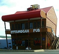 We stopped to photograph an Ettamogah Pub we found along the way. The other one we know of is on the east coast. This west coast version seems very new. The lopsided and goofy design of these pubs is a replica of the pub in the Ken Maynard cartoon series made famous in the Australian and New Zealand Post Magazines. (A quick web search revealed several more of these pubs around the country. We suspect a franchise.)
Obviously we stopped at Baker’s Hill to seek a bakery. We found one, on the highway, and got some apple slices to take with us for morning tea. They didn’t last long.
We also stopped so Jean could take photographs of trains, but she was disappointed that the Indian Pacific didn’t come along while we were anywhere near the tracks.
At Mekering we saw much mention of the Mekering Earthquake. Most of the fault line has been obliterated over the past few decades, since it was in inconvenient locations for farmers.
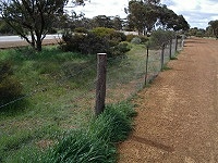 After that it was a pretty boring drive. We stopped to look at a sample section of the rabbit proof fence. The sample seemed to be sponsored by fence companies. The rabbit proof fence was started at the highway in 1901, and completed at Esperance on the south coast in 1903, and at Port Hedland on the north coast in 1907. It is 1837 km long.
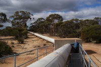 Jean took photos of the Golden Pipeline. This 1903 engineering feat brings water 563 kilometres from Mundaring Weir in Perth to Mt Charlotte Reservoir at Kalgoorlie. The State Chief Engineer C Y O’Connor organised the pipeline to ensure the goldfield driven mining boom continued. The project was publicly criticised and there was political pressure, and O’Connor shot himself dead a few months before the pipeline delivered water.
We turned off the Great Eastern Highway at Coolgardie (pop 1100), and travelled the 40 kilometres out of our way to Kalgoorlie. This simply had more extensive facilities, plus more to see.
We arrived at the Best Western Kalgoorlie (22342 km, pop 31,000, latitude S30.45, longitude E121.28) after a 621 km drive. We are both feeling the cold whenever we emerge from the car. Luckily the last few places we have stayed had reverse cycle air conditioning and soon heated up.
We had a restaurant meal at the motel, since we think it unlikely another will be available for a while, as we cross the Nullarbor. Very enjoyable, with four lamb chops each, although they had run out of the wine we wanted.
The motel had a typical USA style mixer tap on the shower. Realising that visitors may not be able to read the small H, C and Off marked on the chrome surround, they added a plastic sign with a diagram high in the shower. However the shower used one of the very small tap handles, rather than the large ones common in the USA, and was pretty stiff. Someone with arthritis would have had great difficulty moving the handle, especially when it was slippery with soap and water.
Day 60, Kalgoorlie to Balladonia, Tuesday 3 August 2004
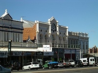 We got away late from the motel. Our first stop was to take a look through the wide Kalgoorlie streets, where multiple buildings from the end of the 19th Century are still in excellent repair. We also found a news agent for the paper, after some searching. There was a fine statue of St Barbara, the patron saint of miners, at an excellent little square near the centre of town. The 1908 town hall is only one of many fine buildings dating from early days.
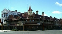 Kalgoorlie has produced more gold than any other site in Australia, close to 1000 tons since 1893. During the peak of the gold rush days, Kalgoorlie and Boulder had a combined population of 30,000, plus 93 hotels and 8 breweries.
Next was the lookout at Mt Charlotte, overlooking the main street, and also the end of the 566 kilometre Golden Pipeline that brings water to the city. From here we had good views of the town. We took photos, and spent some time chatting with a pair of other tourists slightly older than us and sporting much more impressive cameras.
 Next stop was Super Pit, the mine site Alan Bond nearly pulled together. Super pit is the largest open pit gold mine in Australia. At present the pit is 2.9 km long, 1.2 km wide, 250 metres deep. It will eventually be 3.6 km long, 1.35 km wide and 500 metres deep. Mining never stops, and 85 million tons of earth a year are removed from the pit. Most of the 30 trucks you see use a 2300 HP engine, weigh 166 tons, and haul 218 tons away in each load.
We stopped in Boulder, on the way out of the Kalgoorlie area, to collect some lunch and morning tea.
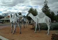 It was a long boring drive to Norseman, which is why when we reached the town centre we photographed the tin camels. The town was named after the horse Hardy Norseman, because in 1894 the horse uncovered a gold nugget. Prospector owner Laurie Sinclair then found a rich vein of gold, which eventually yielded 5 million ounces of gold. Jean changed notes at a bank (when it finally opened at 1:30 p.m.) and Ericskulked around a book exchange. We didn’t stay long, just time to top up the fuel in the car. Prices were on the way up.
More driving long country roads. Trees with red trunks by the roadside interested Jean, as we hadn’t seen these before, so we stopped for photos.
At Newman Rocks we stopped and failed to identify what was significant about the rocks. There was a small pretty pool there, which must attract animals.
We saw yet another eagle as we got within flying range of the roadhouse. We suspect that with tourists travelling early and late near roadhouses, the eagles find it a very fruitful area for road kill, since many animals are on the road at dawn and dusk.

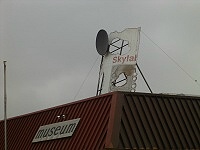 Balladonia Roadhouse (latitude S32.21, longitude E123.37) was where some of the debris from Skylab fell, though not actually on the roadhouse itself, as the decoration on the building might suggest. They had a decent museum with exhibits of Skylab plus much about country life. The replica Skylab pieces were quite well done: convincing until you looked at them closely.
We had a nice deluxe room, well away from the generator so we could hardly hear it at all. Unfortunately we didn’t do as much typing of notes as we had wished, due to our dinner.
Eric bought a roast lamb dinner that turned out to be too large to complete. Jean’s lasagne was also large. We didn’t manage to stay awake all that long after dinner. It was cold at Balladonia, and that discouraged much wandering around.
Day 61, Balladonia to Eucla, Wednesday 4 August 2004
We came across warning signs about camels along the road, but no sign of the real thing.
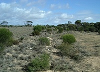
Trees were thicker than Eric expected, as was the grass. At several places there was evidence of recent rainfall. Some of the roadhouses we stayed at or got fuel had a lot of mud around. The last trees were 25 km east of Balladonia, and Eric thought we had reached more typical desert, but every now and then more trees would appear.
 We came across several Royal Flying Doctor Service (RFDS) emergency airstrips, where a section of the main road was made slightly wider, start and ends strips painted upon it, and a sign put at each end.
Then it was the 90 mile straight, claimed to be the longest straight stretch of road in Australia at 146.6 kilometres. Now that is a boring stretch of road.
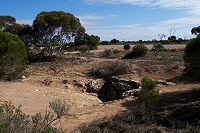 Just before Caiguna we came upon a small sign to the Caiguna cave blowhole. This is just a location where caves beneath the Nullarbor suck in or blow out air in accord with the outside air pressure. The air flow can be very fast at exits from some Nullarbor caves.
This also gave Eric a chance to photograph the trench the Telstra optical cable is laid in. These cable trenches (and large rocks removed from them) can be seen beside many highways in Australia.
 At Caiguna (22929 km) we entered Central Western Time Zone, 45 minutes ahead of Perth. Unfortunately Eric’s Apple Macintosh seems unwilling to let him adjust to this time zone at all, with the choices being either Perth or Adelaide. He was able to adjust his Psion within seconds by simply adding a new city, and setting its GMT offset to an appropriate figure.
The road here for nearly a hundred kilometres is alongside or passes through the Nuytsland Nature Reserve.
At Cocklebiddy roadhouse we collected a lunch, which turned out to the usual super size sandwiches so common in country areas. Cocklebiddy Caves include a 6.7 kilometre underwater cave. The road is dirt and not signposted, but you can climb down a ladder and see the large lake at the cave entrance. We did not try to enter.
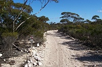
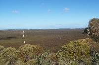 Some 20 kilometres further east we turned onto the gravel Eyre bird sanctuary road. This had 15 km of good and wide but bumpy gravel road to a large communications tower, and then about 4 km of poorer gravel road only one car wide to the lookout over the escarpment. We had some fine views, but we hadn’t been sure what to expect. You can continue to the sanctuary if you have a 4WD. We had our lunch sandwiches instead.
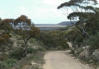
Several hours later we reached Madura Pass lookout, which gave us some excellent views of the pass from the Hampton Tablelands at the top of Wylie Scarp down to the Roe Plain lowland, and the fine wide road through it.
Jean perversely took us down the pass using the old deserted highway, which appeared about a single lane wide. Things must have been exciting in the old days when you met a road train on that stretch. We were not originally sure what track we were on, as we simply went exploring from the lookout.
 Madura had very expensive fuel, worst we have seen this trip. Luckily we only topped up a quarter tank. We should have refueled at the next location, at Munbdrabilla roadhouse, which was about 25 cents a litre less. Jean found that her notes were correct on which was cheap, but her memory had failed her.
Here you are driving on the low side of the Moodini Bluff, which shows as a gentle curved landform inland of the road. This is part of the Hampton Tablelands.
We finally reached Eucla (pop small, latitude S31.41, longitude E128.53) around 5 p.m.
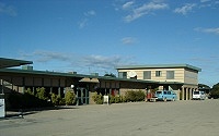 Despite Eric’s predictions several days ago about a scarcity of restaurant meals, we had yet another roast lamb dinner. The restaurant stocked Lamonts wines from Margaret River, which we had not tried before, so we had the cabernet merlot (listed incorrectly in the menu as just merlot), but the sample bottle clearly showed it was not. We followed this with chocolate mudcake and icecream. All very excellent.
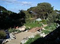 I must mention that there was a charming little rock garden with a large, well lit fish pond outside the dining room. It made a wonderful distraction from the cares of the day. This garden has been worked on by various staff for many years, since the original owners started it as a cactus garden. Next morning we took some daylight photographs, and it was more extensive than we could tell from inside the dining room. However lighting at night made it look even better than the daytime view.
We did manage to catch up with our notes and downloading photographs, ready for the next bunch of activity.
Day 62, Eucla to Nullarbor Roadhouse, Thursday 5 August 2004
While we got up early, we didn’t have any reason to rush off as we have only a short drive today. There are several things to see here at Eucla.
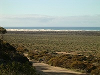 Eucla motel has a small but nicely done museum of the early telegraph and phone materials in the area, as well as other local history. Good to see a place trying to keep together these relics. Unfortunately Eric recognised an entirely too large section of the electrical exhibits as things I had picked up at dumps and played with when a child. These museums certainly make me feel old.
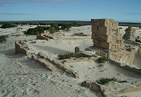 We went down the escarpment about four kilometres to the dunes, to where the partly sand covered ruins of the old Eucla telegraph station still stand. This really looks ancient and badly treated.
Once back on the highway, the nearby border crossing from West Australia to South Australia had a couple of wind turbines, however they seemed not to be picking up any breeze. Luckily they also had solar cells.
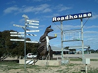 There was also an interesting roadhouse. Apart from the signpost to everywhere (mostly remote, as you would expect here), they also had a giant kangaroo holding a Solo can. Eric was much taken by the chapel. Jean thought it was so anyone could pray before the long drive across West Australia.
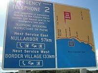
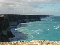 The first thing we noticed about South Australia is that unlike West Australia none of the roadside rest areas had toilets. Although it is less than 200 kilometres to our next overnight stop, we were visiting every ocean viewing site along the way, so we were expecting a leisurely drive, and did notice the lack of facilities.
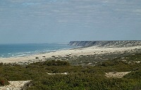 Viewing points along the coast varied greatly in what you could see. At most of them the crumbling nature of the Bunda cliffs made me very nervous about where I was walking when near the edge. If you managed a good view of some of the cliff edges, you could see some were undercut by the sea, which was crashing against them some considerable distance below. You could also see the results of past cliff falls from these 40 to 90 metre high cliffs.
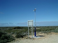 Despite this, there were some good spots for photos, so it was worthwhile visiting the coast at every opportunity.
 We saw some additional wildflowers at some of these viewing points.
We reached our evening destination, Nullarbor roadhouse (latitude S31.27, longitude E130.54) mid afternoon, but stopped for only a minute or two for photographs before the light was gone. We thought that if we stopped and got our pre-booked room we wouldn’t have the momentum to continue to the Head of the Bight whale viewing area.
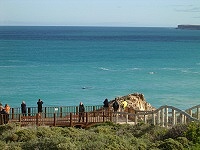 Entry is $8 each, at the White Well ranger station a few kilometres in from the main road. When we reached the coast we noticed a brand new tourist centre is being built not far inland from the cliffs, with solar power and wind turbines, and toilets.
The seaside area now has an extensive range of wooden walkways which both make it easier to partly descent the hillside, and also provide a wide range of views of the 40 to 90 metre high Bunda cliffs which extend unbroken for 200 kilometres to the west.
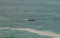 The popular event here is viewing the Southern Right Whale (Eubalaena australis), as schools of the whales moved west very close inshore. Many were accompanied by calves. Some did displays of fins and tails and generally disported themselves in a manner pleasing to photographers.
Even without the whales, you have a wonderful view from here of the cliffs to the west.
Day 63, Nullabor Roadhouse to Ceduna, Friday 6 August 2004
 We visited the whales again, despite it being very windy and cold, with overcast or rain.
On our way to Ceduna, we diverted from the highway through white sand dunes to the town of Fowler’s Bay on the coast.
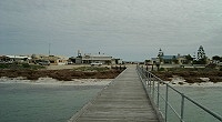 We reached Ceduna during rain and with clouds when the rain stopped. We had prebooked at the Best Western Ceduna. That turned out to be a great location, right across from the water (not that the weather allowed us to appreciate the great outdoors).
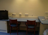 We had a newly renovated room, that will probably go down as the great room of the trip. It had sufficient typing space for both of us, despite sharing it with a TV. It had no less than 12 power points within easy reach of that built in desk, 8 of the power points directly above it. It had the Internet phone line directly above the desk. It also appeared to be wired using structured wiring, ready for a future upgrade to Ethernet connections. The lighting was wonderful: six downlights for the general room, four more in the kitchen sink area, plus two directly over the desk. It also had bedside lamps. We have not encountered any motel room with better lighting, anywhere. We ate dinner in the hotel.
Day 64, Ceduna, Saturday 7 August 2004
Rest day, punctuated by Eric attempting to buy a Weekend Australian newspaper. It wasn’t available at the newsagent, because the truck didn’t arrive. Various rumours of what had happened to the delivery truck.
Just before six, when the supermarket closes, Eric ran through the rain and tried again. The newspaper had arrived! The newspaper had sold out!
Day 65, Ceduna to Port Augusta, Sunday 8 August 2004
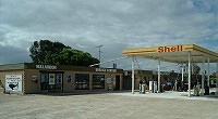
When we refuelled at the Shell service station before leaving town, Jean searched assiduously in their store for a weekend newspaper. She found a very small pile of the Weekend Australian under the loaves of bread. The cashier asked her where she had found them, as they thought they had sold out. So we did eventually get our newspaper.
South Australia was closed on Sunday. It was sometime well after Ceduna that we saw the first speed sign in the state. We did see a wonderful pink car at Kimba. When we got to Port Augusta we found Coles was open so we restocked our food, and Coles Liquorland (we were out of wine), and found the location of a Coles Express service station. That was a pretty successful shopping trip for a Sunday.
We stayed at a cabin at a caravan park a bit of a distance out of town. Since the room had a small stove and a microwave, and all cooking facilities, we had dinner there.
Page last updated 21 April 2005
