
(Click on photographs to see a larger version. Note: Some file sizes are quite large; not recommended for people using a dial-up connection.)
Friday 12 August 2005 – Fitzroy Crossing to Derby
Fitzroy Crossing (S18 10.9 E125 33.5) -> Derby (S17 22.2 E123 39.6).
After a fine breakfast we wandered around the Crossing Inn looking at the boab trees in the grounds.
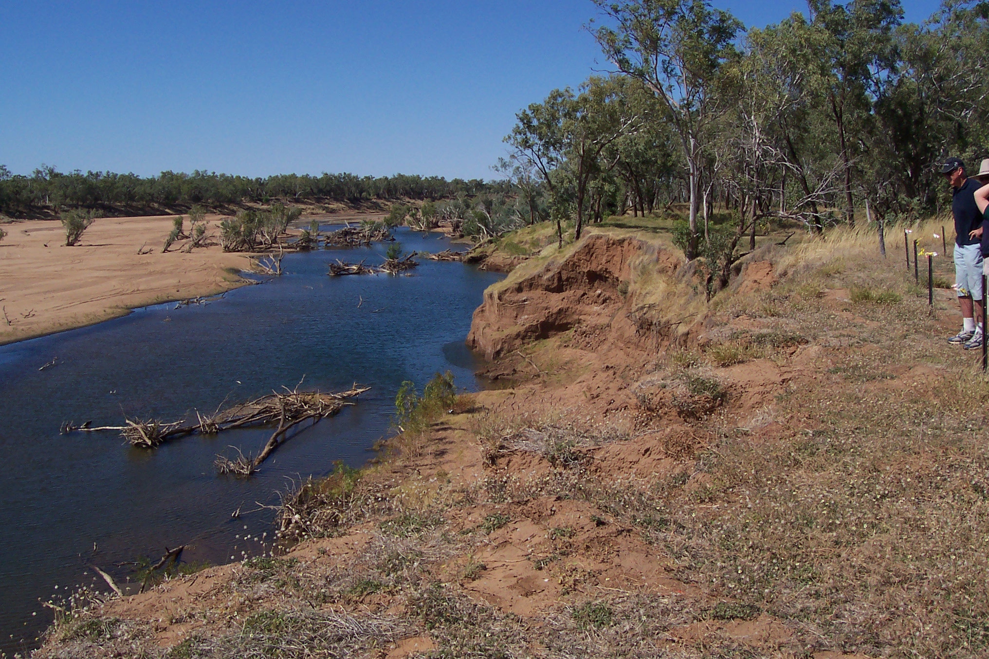 Vehicle tour around Fitzroy Crossing. We visited the old graveyard, where the graves are gradually tumbling into the river as the banks are washed away. (Photo left: Fitzroy River near old graveyard.)
 In 1935, the Fitzroy got its first crossing, a low-level concrete structure, which was built up into a wider structure in 1958. This bridge could be closed for months at a time during the wet weather. Last year, when on our own, we didn’t manage to find the old crossing, but the tour this year took us to it. (Photo right: Low-level crossing of Fitzroy River.)
When a new bridge was erected in 1974, the focus of the town grew away from its original site. The current townsite of Fitzroy Crossing is one of the fastest growing in the Kimberley, due to Aboriginal resettlement, mining and tourism.
David Marks, our tour director, prevailed upon the local Wangki Yupurnanupurru radio station to give us a tour, as a sort of spontaneous addition to the tour. It was interesting to note the announcer giving the time as an approximation, rather than declare it exactly.
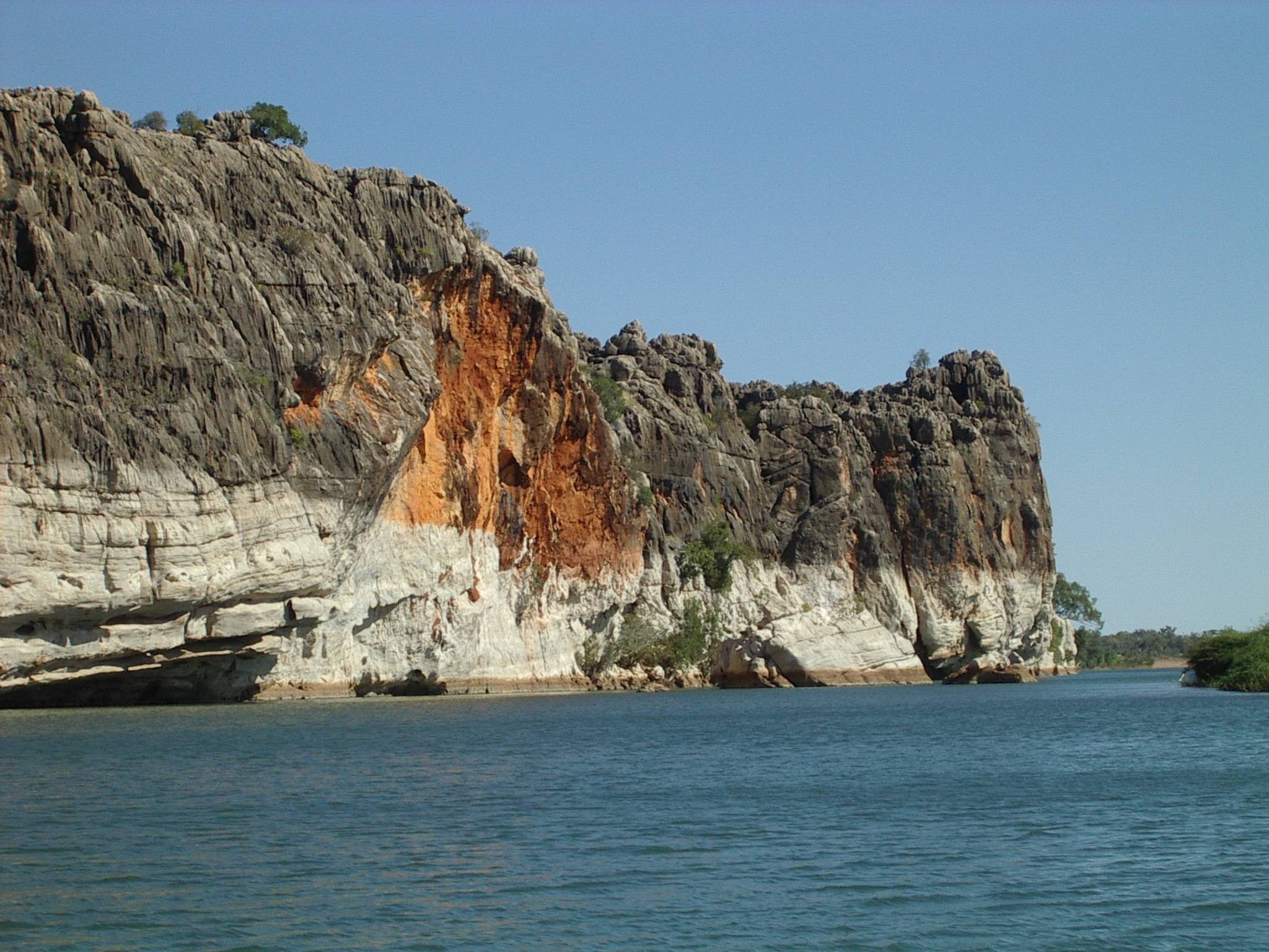 We had an early BBQ lunch prepared by chef Andrew at the Crossing Inn, and then headed out to Geikie Gorge National Park, 18 km northeast of the town, for a boat cruise along this spectacular cliffside waterway. Many caves in the gorge have wonderful examples of ancient Aboriginal art. (Photo left: Geikie Gorge.)
The Geikie Gorge National Park covers an area of 3,136ha. This exquisite gorge has beenformed by the Fitzroy River, which over the years has sliced through an ancient coral-based limestone barrier reef. 14km long and approximately 30m high.
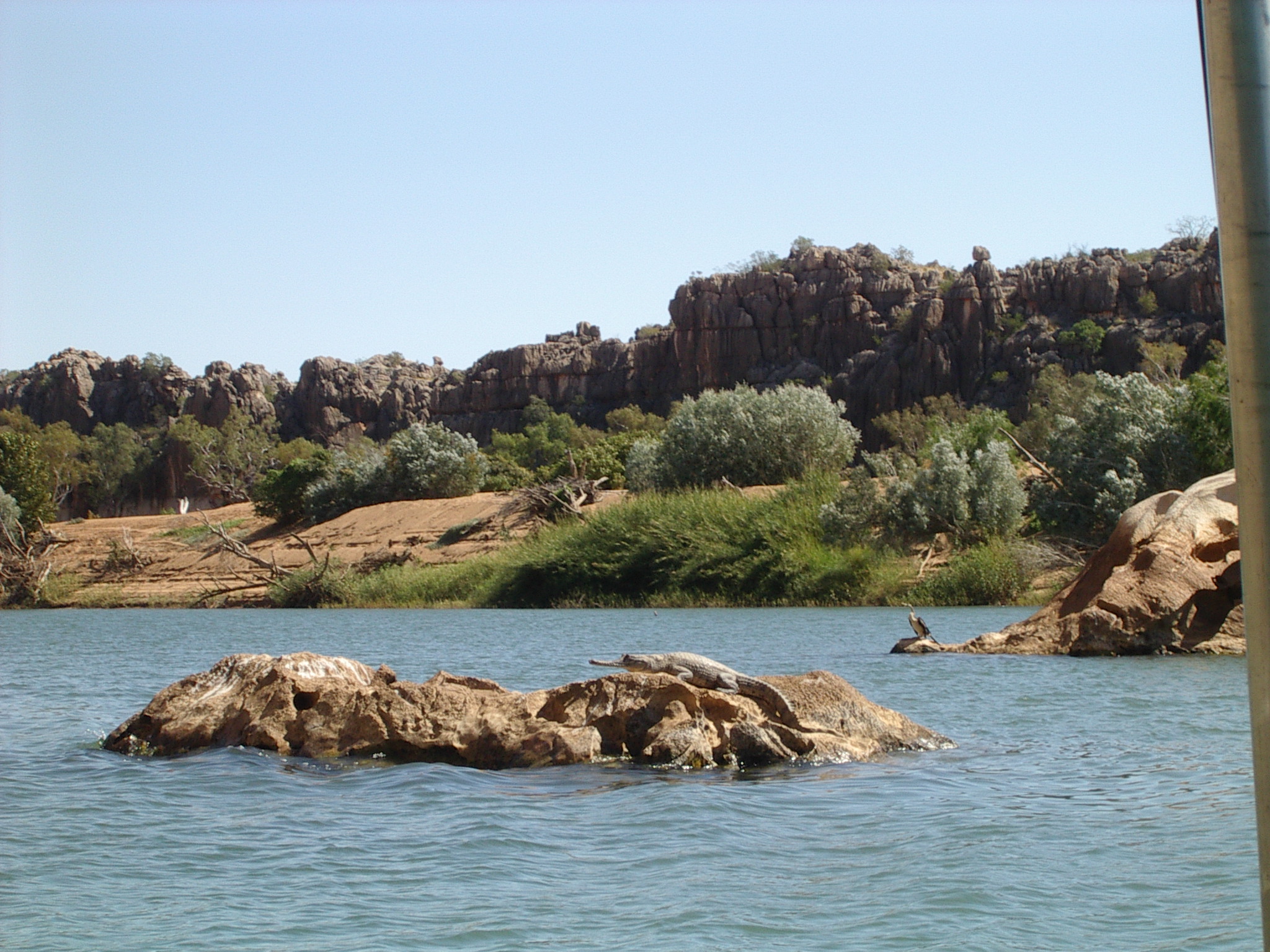 Flood action reaching a height of 16m above the normal level has left the cliffs white and fossil deposits are visible. The different colours on the rocks of the gorge also show just how high the water reaches during the floods. We had a good view of the overhangs and worn nature of the rock, honeycombed with holes. Naturally there were a number of small crocodiles sunning themselves along the banks. There were darters, drying their wings in the sun. Saw some eagles, plus their nests. (Photo right: Crocdile and darter at Geikie Gorge.)
Our previous visit in 2004 had not included landing during the cruise. Also, we had taken an early morning tour, so this time the light was at an entirely different angle and revealed different aspects of the gorge.
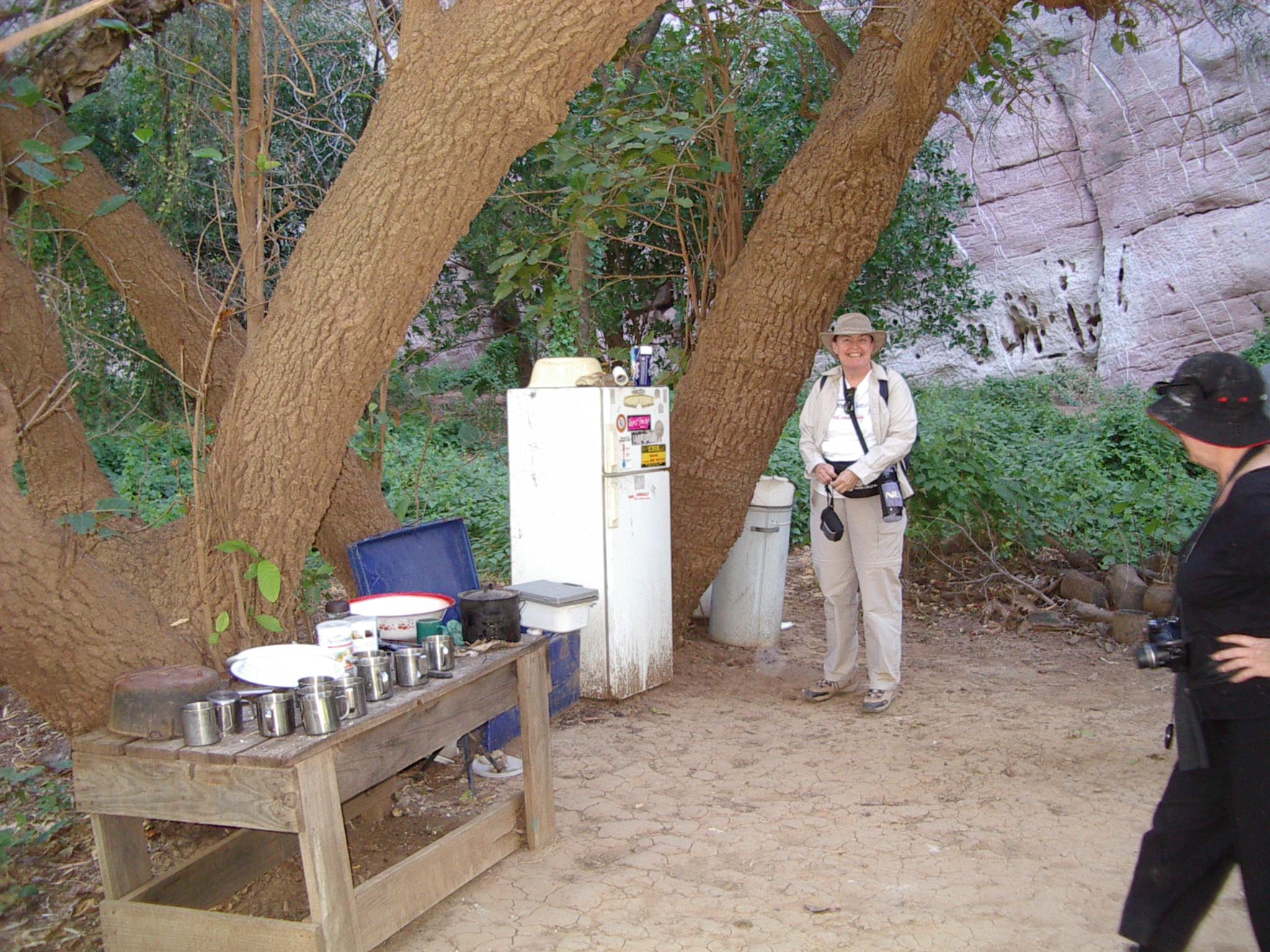 Our guide Bill Aiken of Darngku Heritage Cruises gave a very impressive talk and role play on native customs as we had billy tea. It was very different to the usual tourist talk, and some of the party thought it too aggressive as an approach. I thought it gave a good introduction to how customs were different between different people. (Photo left: Tea area at Geikie Gorge. No, the fridge does not work!)
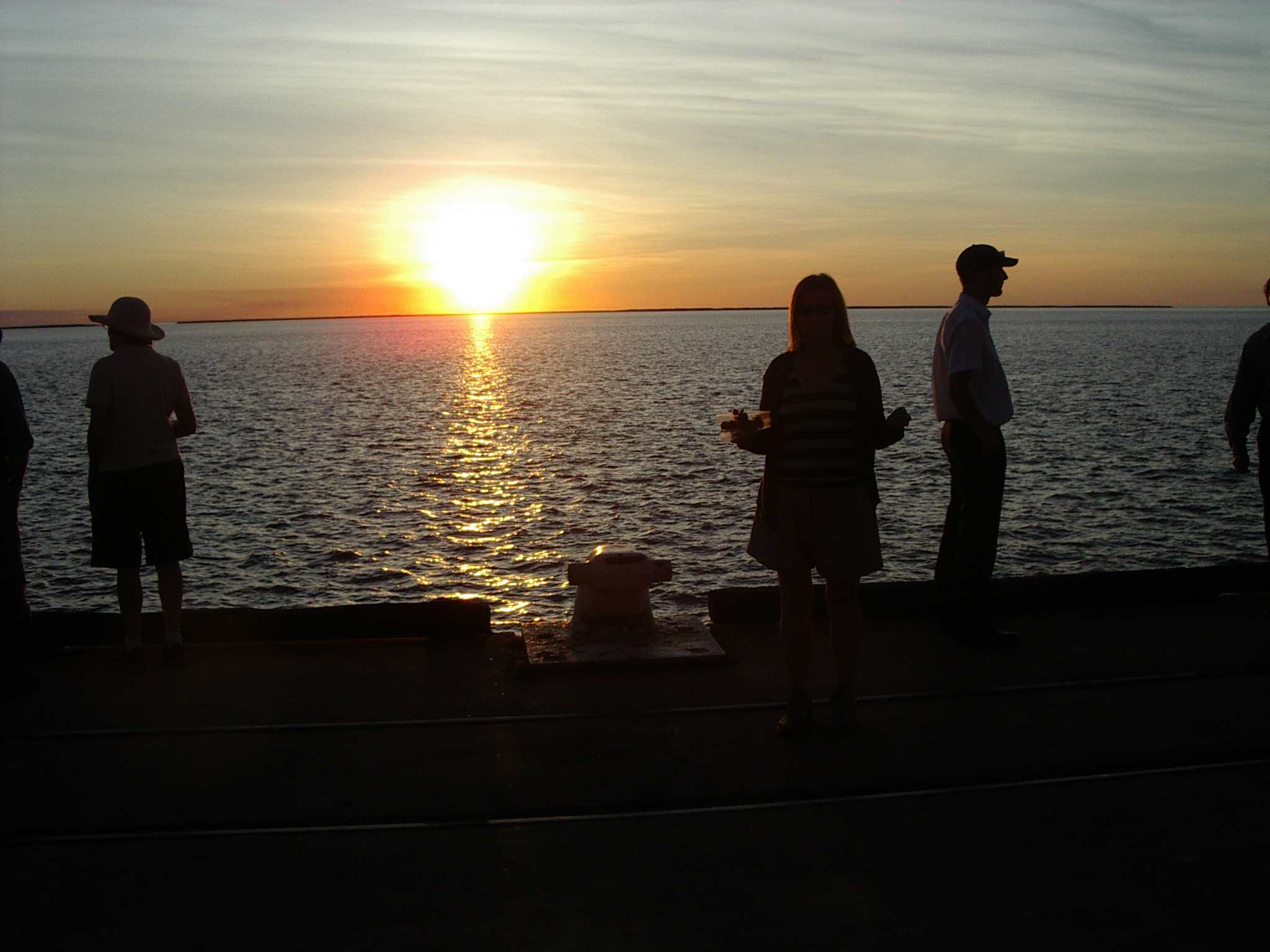 We flew on to Derby (-17 22S 123 39E) on King Sound on the north west coast, where we toured the town and then headed out to the very popular jetty to view the sunset. (Photo right: Sunset at Derby jetty.)
On our previous visit in 2004, we had managed to get views at both high and low tide, by visiting morning and evening. What we hadn’t seen previously was the wharf building lit so that it almost matched the sunset as we left.
We stayed overnight at King Sound Resort in Derby. (08) 9193 1044 (-17 18S 123 37E), where we had stayed in 2004. The rooms are comfortable (but the air conditioners noisy), and the buffet is good, at least for the sorts of things we like eating.
Saturday 13 August 2005 – Derby to Beverley Springs by way of Broome
Derby (S17 22.2 E123 39.6) -> Broome (S17 57.0 E122 13.7) -> Cape Leveque (S16 24.0 E122 55.0) -> overfly Cockatoo Island (S16 05 E123 37) -> aerial view Talbot Bay -> Beverley Springs (Charnley River Station) (S16 44.0 E125 26.0).
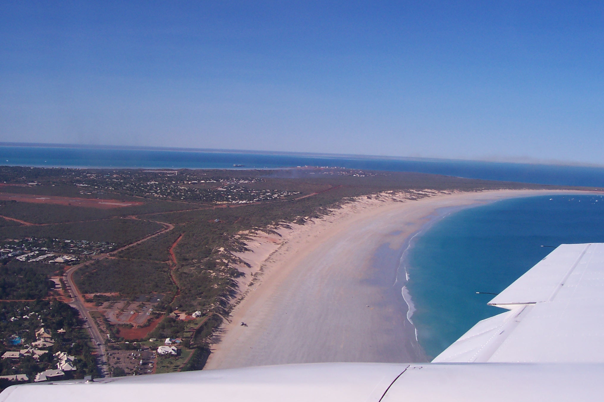 A big day today. Leaving Derby, we flew to the old pearling centre of Broome in the far north of Western Australia for a vehicle tour, landing before 8 a.m. Our pilot Tim took us in on a course that gave us good views of the ocean, the port facility, and the famous Cable Beach. (Photo left: Aerial view of Cable Beach, Broome.)
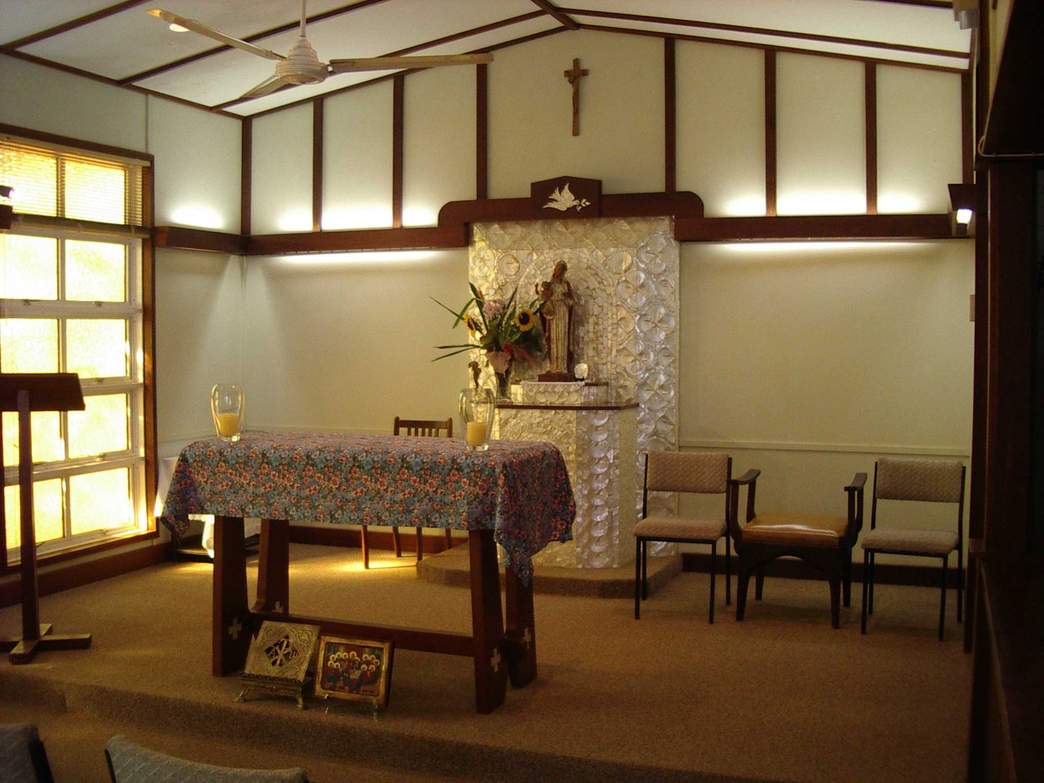 Our bus tour of Broome gave us a good look around the town, passing the Saturday town markets in the Court House grounds. The old Court House is a splendid building, dating back to much earlier times. We stopped at Our Lady Queen of Peace Catholic Church, which has an astonishing interior. I don’t think I’ve ever seen a mother of pearl altar before. The paintings in the church looked like a mixture of traditional Christian religious art, and Aboriginal influence. It is not a tourist place, but a genuine working church. We missed this church on our previous visit to Broome. (Photo right: Mother of pearl altar in Our Lady Queen of Peace Catholic Church, Broome.)
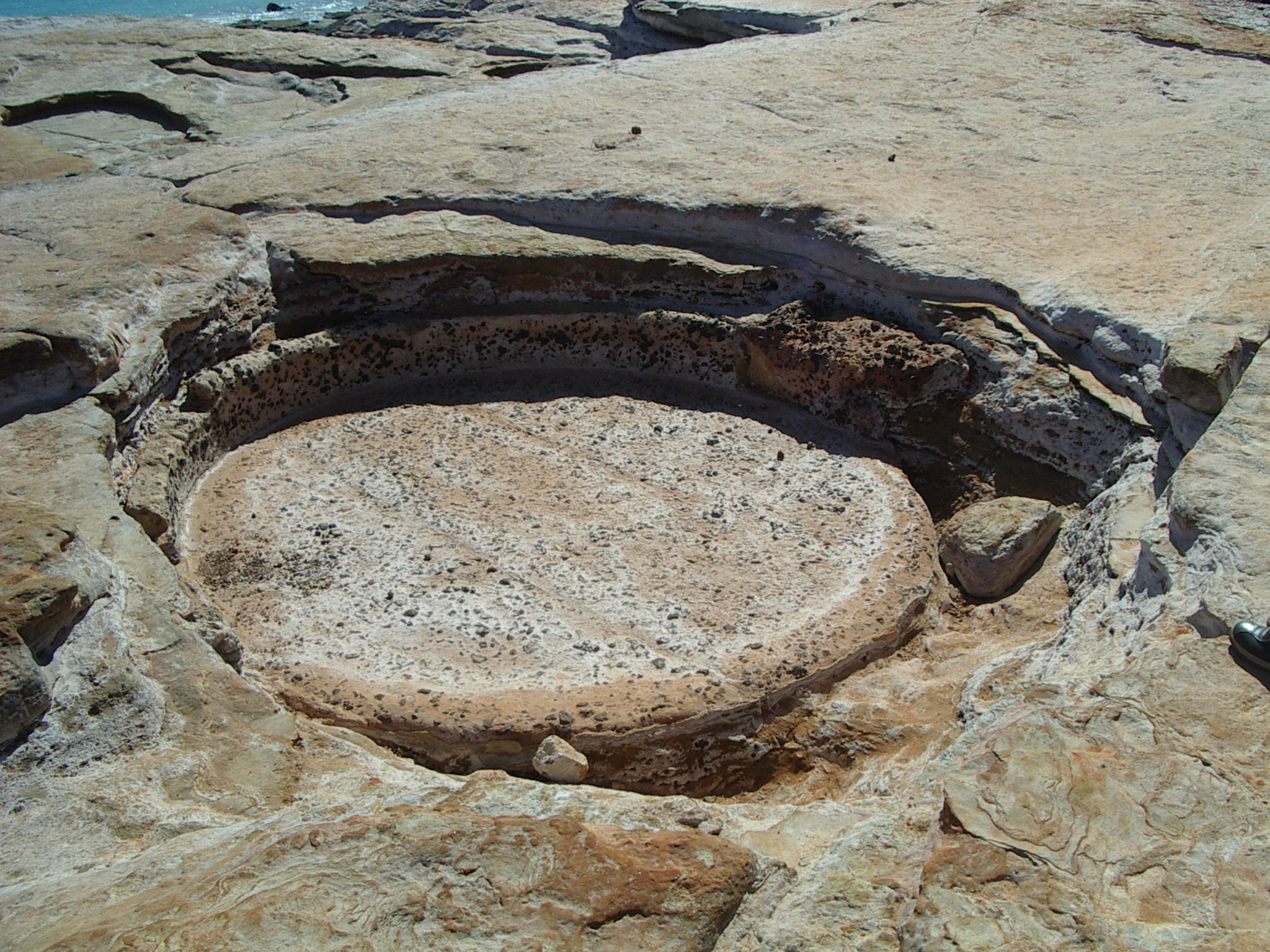 We continued through Broome out towards Gantheaume Point, where we walked past the lighthouse, notng the osprey nest on the platform below the lighthouse lens, and looked at a replica of dinosaur footprints exposed at low tide. Nearby is Anastasia’s Pool, a rock pool made by a lighthouse keeper for his arthritic wife. It was entirely hand cut, and must have been a massive amount of work. (Photo left: Anastasia’s Pool, Broome.)
As well as the dinosaur footprints, there are some very pretty rock formations, some of which show the extent of the tidal variation (over 8 metres) in this area.
We encountered smoke and fire as we continued along the road to Cable Beach. The black kites kept swooping through the flames, obviously finding insects or small animals forced out of the grass or trees by the fire. I’ve never seen a bird use fire as a hunting aid previously.
This was near the Turf Club. Broome has horse races most weekends during the dry season, and this week was part of their major race season.
Next was a visit to the port facility and the beaches leading to it. We also visited what is probably the highest point in Broome, the golf club. This had an extensive and beautiful looking green below the clubhouse.
We drove off via Town Beach and the seashore. We had a brief Chinatown visit. Around midday we continued to Cable Beach, which stretches for 22 kilometres, and was named after the underwater cable which linked Broome to Java.
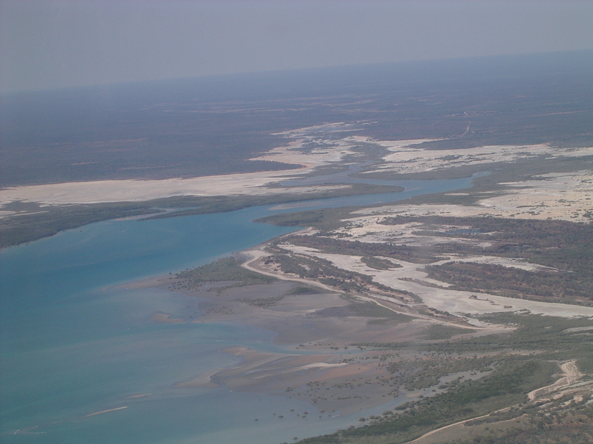 We flew off just before 2p.m., getting a great view of the coast most of the way north. As we got further away from Broome we saw smoke from bushfires all over the place. Most of the coast seems to have extensive sandy beaches. (Photo left: Coast north of Broome.)
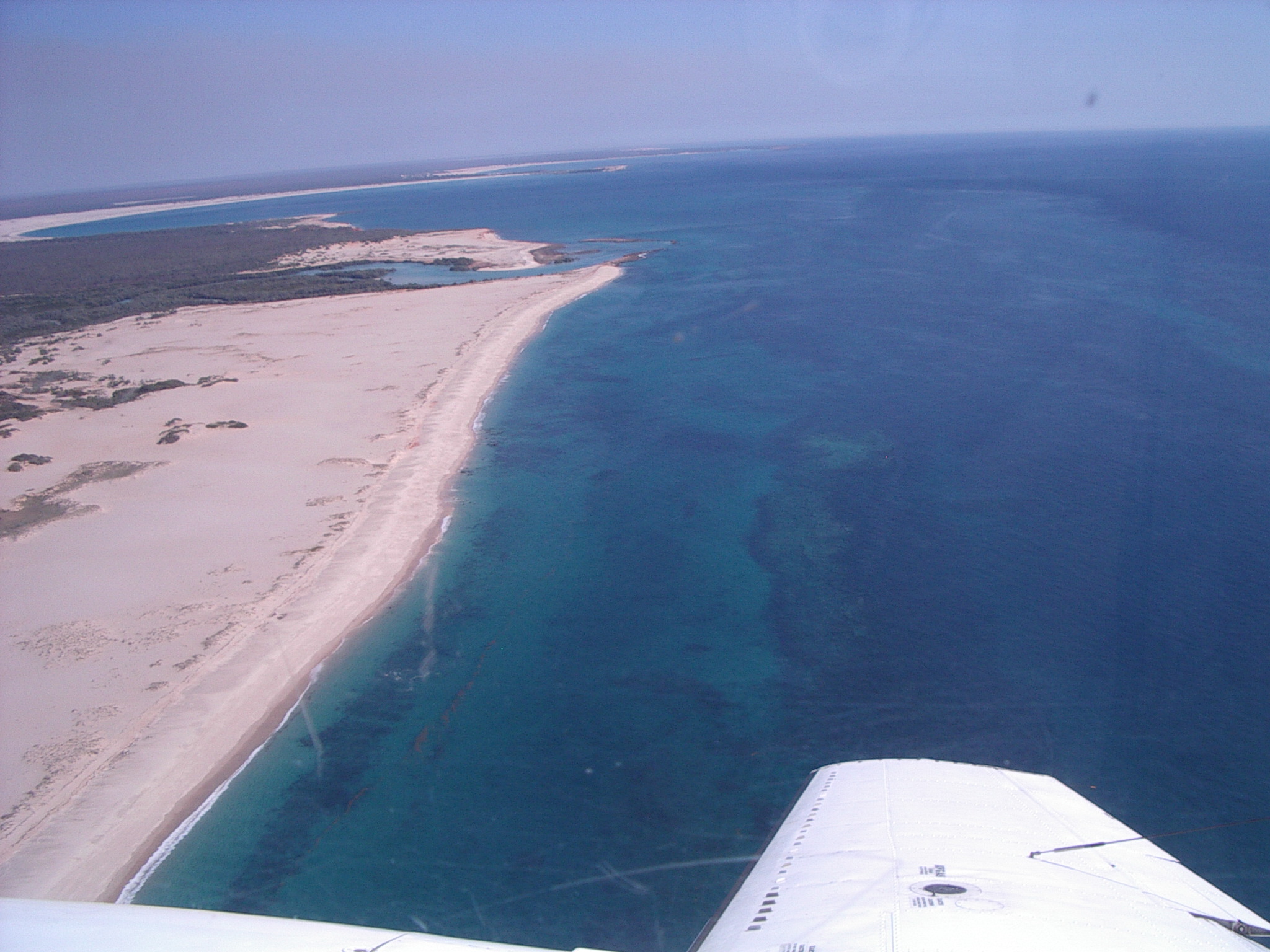 Our first destination was Cape Leveque on the Buccaneer Archipelago, where we were able to visit the lighthouse, the beach and the headland. There is an expensive and remote tourist facility here. On our way there, we saw whales a long way offshore. (Photo right: Cape Leveque.)
This dirt strip was a fuel stop, however fuel was not available, despite both prior arrangements and confirmation of arrival by the supplier. The person on duty at the resort had a bad attitude, basically that it was our problem and we should go away and stop being a nuisance. We finally got fuel after the pilot Tim arranged to borrow some from another aircraft outfit. After pumping the fuel with our slow pump (Tim is not impressed with pump), we went and closely inspected the entire fuel dump. Our fuel drum was there, despite the denials by staff. We have the photos to prove it. We were not impressed by the staff attitude nor their records at Cape Leveque. Tim added checking the fuel dump to his list of precautions when flying in isolated areas. We never had a fuel delivery problem in the rest of the trip.
When we left Cape Leveque, we flew over Yampi Sound, overflew Cockatoo Island, and had an aerial view of Talbot Bay. You could clearly see the mining camps and the way the island had been mined into terraces.
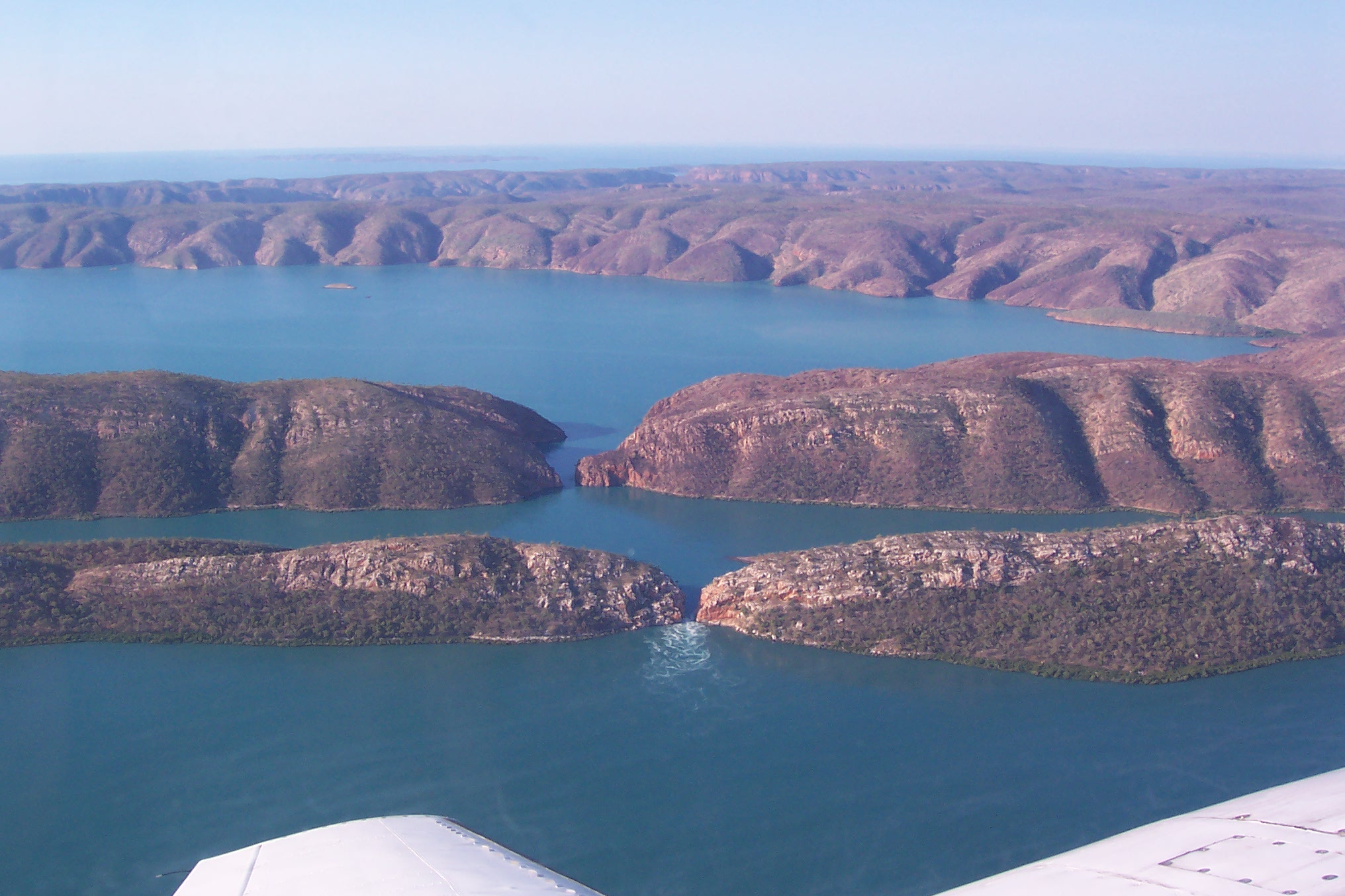 The big event was viewing the horizontal waterfall, caused by 40 foot tides through a narrow opening in an island escarpment. The water piles up higher on one side than on the other, and rushes through the narrow gap. The tide was almost full, so it was less spectacular than at some times. (Photo left: Horizontal waterfall.)
Page last updated 26 December 2005